
A day up Mount Rowe, via Moss Creek Track
Tackling one Thames Coromandel maunga, with striking views of the famous Pinnacles.

Track: Moss Creek Track (mainly)
Level: Moderate, backcountry
Distance: 12.5km
Time: not rushing, taking all the things in, 8 hours return
Take: Navigation, anti-cutty grass suit (if you have one), water purifier to taste all the streams (if that's your gig)
"Is this New Zealand's worst tramp?" challenges the Wilderness magazine headline. Like a red rag to this Taurus, this only provoked an instant desire to attack Table Mountain and tick it off. To be fair, just seeing the unusual, trapezoid shape of Table Mountain from a nearby track over Easter 2018 was enough. Its flat-top qualities reminded me more of things seen in maths class than anything from the geography department, let alone the triangular alps a Year 3 student might draw in art. Wilderness magazine's 2013 piece about their trip to the 'Table top' reads like utter hell: mud-filled canals, an assault course of fallen trees and enough cutty grass to leave you feeling like you'd gone ten rounds with Freddy Krueger (I might be writing from my own experiences a bit now!).
I wanted a test-run before smashing this one out and Mount Rowe, en route to the Table, seemed like the perfect day. With New Zealand's shift from COVID-19 Alert Level 3 to Alert Level 2, came an intense desire to get outdoors proper. Deemed 'essential' by the work gods, little had changed for me during lockdown, except for the surprisingly tiring aspect of having half the team working from home. Small conversations become mini-articles, 100s of words typed just to liaise with your colleagues. Add to that the uncertain landscape the media industry finds itself inhabiting right now, and... (too much talking shop, Dunc - this is meant to be a piece about actual landscapes!).
There were a few things I required from my first post-lockdown trip into the wild. It had to have views, I wanted to see peaks and the ocean. I planned to leave Auckland as the sun rose, but I didn't want to overreach and be racing the clock all day; if I liked a spot, I wanted time to sit down and enjoy it. Also, I wanted to isolate. Everybody else had gotten to isolate during the lockdown - working from home, staying away from others in their bubbles - whereas I'd just carried on as normal, in the middle of a great big city. I needed to get as far away from that as possible.
With this in mind, I made the decision to head to the Coromandel Range, follow the popular Pinnacles track for roughly 20 minutes, then turn off onto the route-less-smashed along Moss Creek Track to Mount Rowe. Within five minutes of exiting the main drag, I was served a real backcountry treat. The trail meets the Kauaeranga River by a beach, stacked with large rocks. Many of them flat enough to perch on for some breakfast and I did just this.
The sun was beaming down the valley, bouncing off a small pool in the river with a glisten - actually this glisten was winking at me, saying "you go for it, son!". A wire bridge ran the width of the river overhead. "I've got to use that!" I decided - more for fun than any necessity due to the river's depth, which was still running on low thanks to the recent drought.
After 20 minutes or so hanging in this post-lockdown paradise, I pushed on, sliding myself carefully over the wire bridge and into the nīkau-clad forest above the high river bank. Clinging to the river's path, the trail crosses a creek with a neat set of waterfalls pouring out of the bush. Then a second which had suffered a monster slip, leaving trees and huge rocks scattered on the now meek-looking creek bed.
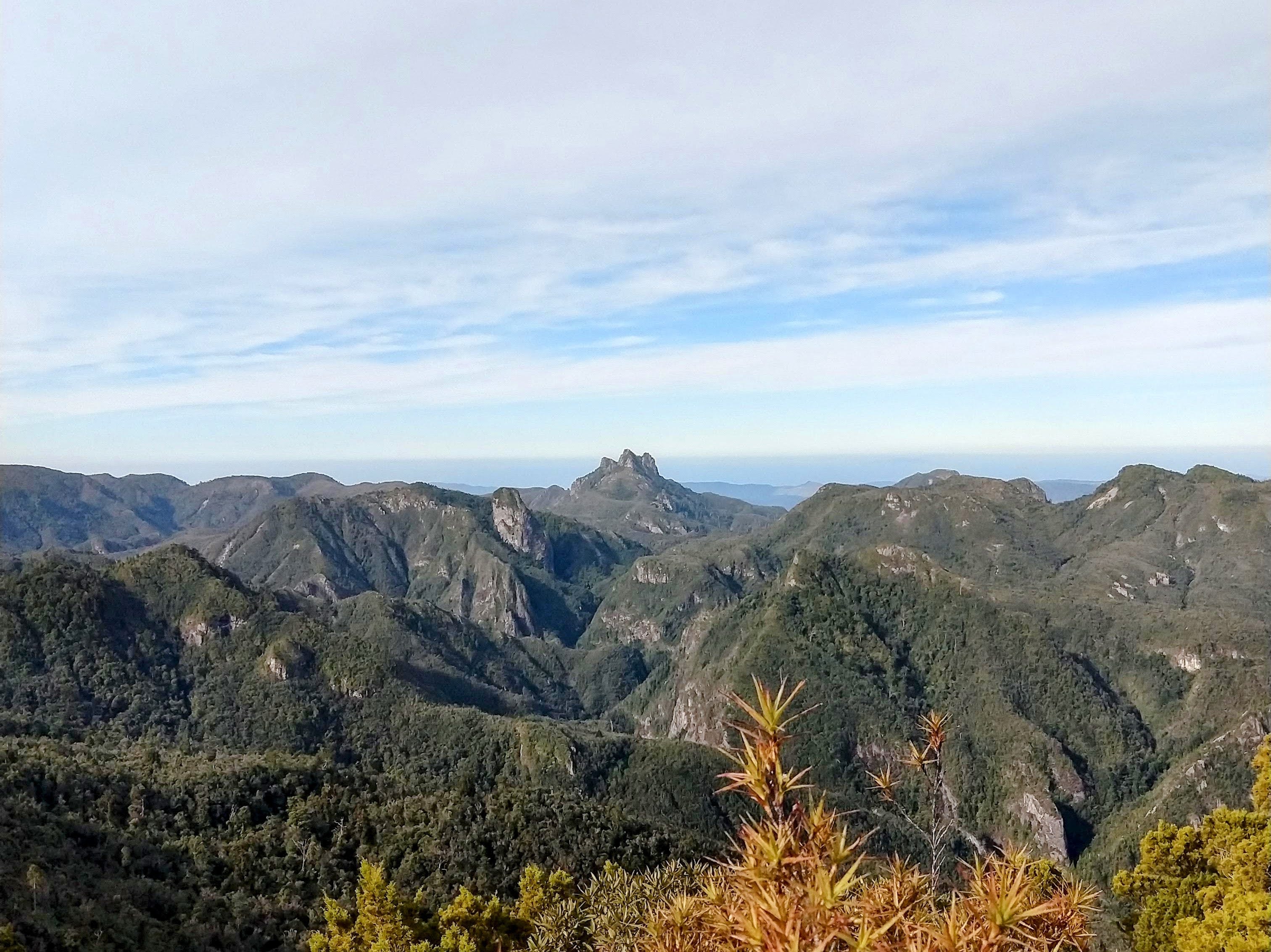
After about a kilometre, the climbing begins. A sign also offers trampers a 30 minute trip to the Kauaeranga Gorge, but today I'm heading up. And up the trail leads, gently at first, but steepening sufficiently at times to ensure extra care is required negotiating the slippery tree roots safely. Occasional gaps in the trees allow a glimpse at the stunning ranges on the eastern side of the valley and the grandiose Tauranikau and Pinnacles. These impressive, 700 metre high, giant rock forms impose on the skyline like lone teeth. It's no wonder they're the main draw to the area. Satisfied just to view them this time, I traipse on and the gradient levels off for an interesting flat shelf on the side of the mountain. It's here I find a small troop of werewere-kōkako.
Werewere-kōkako - New Zealand's blue mushroom - are a vivid unforgettable sight. Their Smurf-blue flesh stands stark against the deep greens and soft browns of the Kiwi native forest. I'd only even seen them on the Heaphy Track, while cycling The Big Loop, so this was my first North Island sighting.
After kneeling for several minutes to photo these kikorangi wonders, I move on, enjoying a new-found speed over the flat ledge. The centre of the ledge is marked by a small stream, flowing loudly through the forest, then the mountainside gradient ramps up. This trail is marked using the classic DOC orange markers and most are easily visible, making navigation simple enough (not that this route should be attempted without map and compass or GPS - just in case).
The forest ends briefly to make way for a huge slip, this one beating the earlier one for size. I only have to traverse a few steps across its top left corner, but I pause partway and turn to view the scene of devastation beneath. Trees of all sizes and weights have careered down the slope, taking rocks and mud with them, leaving a rotten scar on the landscape. My mind fills with the sound this fall must have created; one moment the bush is there, the next its all in a pile at the bottom. What an event! No human would stand a chance if they faced the misfortune of being caught in one.
I hurriedly bounded off the scar and back into the forest, launching up what soon becomes the final ascent onto the 700 metre ridge. It's the steepest section of the day and the trail makes use of giant exposed tree roots, step-shaped boulders and a man-cut drainage canal to assist human users upwards. Not that humans are the only species wandering the area. As I clambered up the steep rocks, locking one foot in after another and gently pushing up the near-vertical sections, I heard a nearby creature rustling leaves. It sounded mammalian, too large to be a bird.
My mind jumped to two memories: the first was two years earlier, when a mate Forest and I were tramping just north of here. We rounded a corner to find a goat just stood there staring at us. One more step and it turned and bolted down the hill. So, I knew there were goats in these parts. My mind then jumped to one year ago, while exploring the eerie and fascinating Dinorwic Quarry, in North Wales. I'd reached a high trail and found myself blocked off by a tribe of goats. Most of them scarpered, but one, a bolshie little kid, came at me. I turned and he butted my ass with his horns. I pushed him back with my hands behind me, but he tried a couple more times as I ran off to find another route. Adrenalin flowing from this memory, I picked up the pace, eager to not hear the rustling any more.
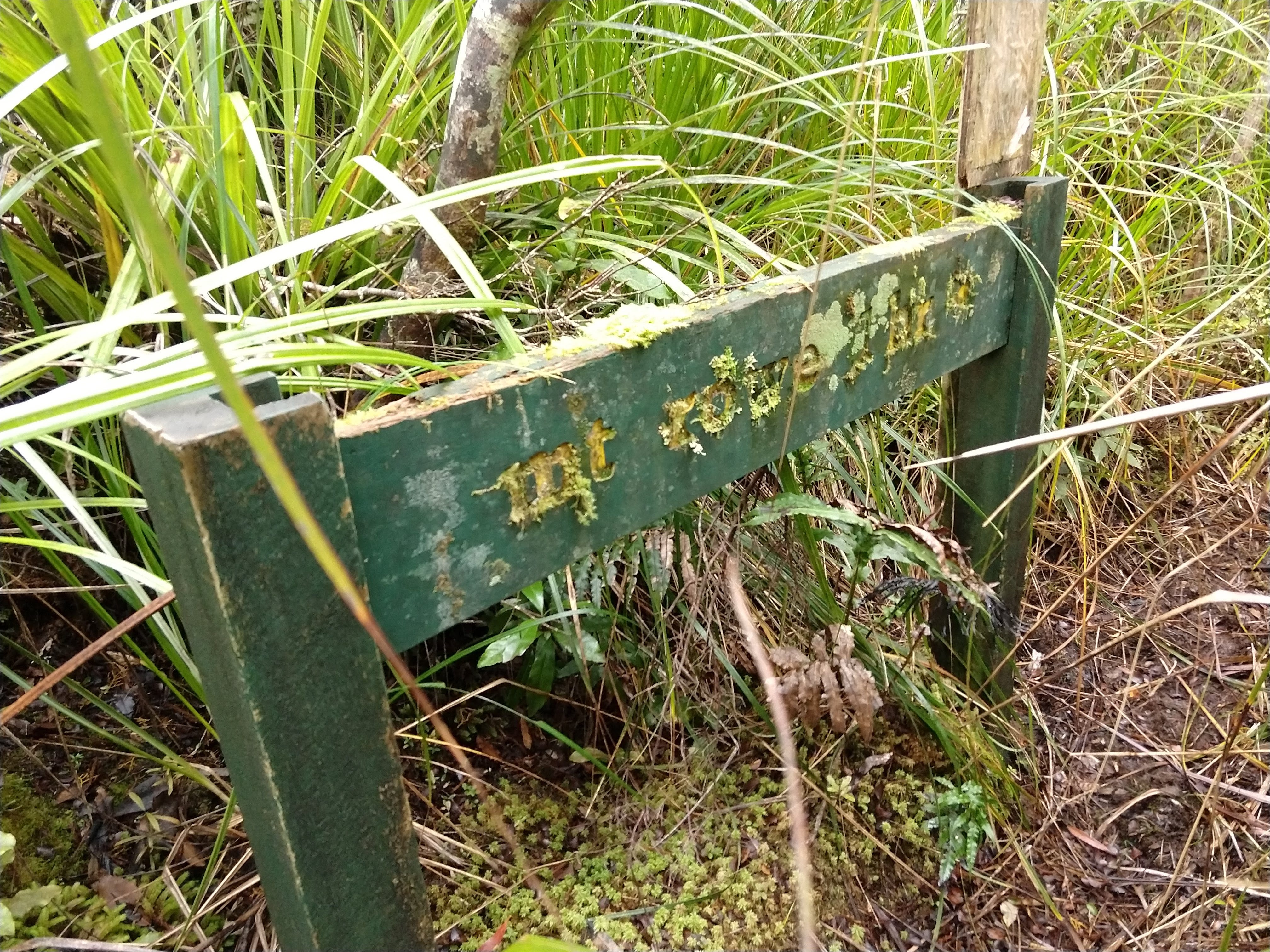
The track levelled out and a new hazard emerged: cutty grass. All the cutty grass; lots and lots of cutty grass. At first the trail was wide enough to avoid contact with the sharp blades, but things soon changed. To my left I happened to spot an ageing green DOC sign, signalling the way to Mt Rowe (and on to Table Mountain). This route has been all but abandoned by DOC. Wilderness Magazine's article mentions lots of mud and to keep the route navigable, DOC were apparently going to have to boardwalk it, instead choosing the 'mothball' option.
After the turning, swathes of cutty grass encroached on my personal space. It protruded from all directions. Some even apparently pointed down from the sky, which took me by surprise when a sharp piece scratched me just below my left eye. I pushed on, soon forced onto all fours to clamber under fallen trees. The dryness of summer was keeping the mud to a minimum, as I followed the squiggly path through the razor-sharp jungle, only briefly losing my footing to a hidden soft patch. Losing the orange markers was the bigger threat. This happened a couple of times, but the GPS marker on my Topo map app came to my rescue. Don't attempt this without some form of navigation!
As the summit nears, the wooded forest gives way to lower shrubs and younger trees. The white-painted tip of the trig tower pokes above the bushes and through the clearing. Don't expect to sit and enjoy the view of the Pinnacles and the Pacific, though. While Mt Rowe does offer these things, I had to stand on a ground lump to see over the bushes and fully enjoy.
After a solid half hour, entirely alone, listening to a goat bleating far below, taking lunch and a few photos, I bashed back through the cutty grass to the junction. Maybe I'd turned the grass blades round on the way through, but the return left me with far more slices to my arms and legs. There was blood.
With enough time until sunset, I went to check out Moss Creek Campsite. NZ Topo Map shows the order on the trail as 'campground, then old dam', but in reality the order is 'creepy hut with abandoned sleeping bag on bunk, then old dam, then campground with view north across Whitianga'. You'd definitely be less freaked out camping here with somebody else rather than alone.
I returned the way I came. Aside from losing the markers a couple of times, plus some extra care on the slippery, steep rocky section, it was a faster version of the way up and I was soon back beside the river, meandering my way back to the car. A wholesome, awesome day. I may not have conquered the Table, but I hadn't been put off trying someday!