
Why you should hike Earnslaw Burn Track in one day... and why you should stay overnight
You know you want to hike Central Otago's Earnslaw Burn, but you can't decide whether to smash it in a day or camp overnight up top. Try my quick guide to making the right decision for you.

Today, we are in the presence of a celebrity. Not a Hollywood icon, not a centenarian crooner and none of this royal eminence parp, neither. Today’s celebrity is famous from the 21st Century way of doing things: it’s famous on the internet. It’s one of the most social-media-idolised in recent times and this VIP isn’t even a human1. It’s a tramping track; the much-revered Earnslaw Burn Track.
Of the many things named Earnslaw around Lake Whakatipu, the ones I can immediately point to are the steamship and the mountain. But, there are others. All these Earnslaws come from a single naming source: a Scottish village in the parish of Eccles, Berwickshire, close to the border with England. Earnslaw Burn is another such spawn of the original Scots Earnslaw, but what’s a ‘burn’ in this context?
To a speaker of English as a second language, a ‘burn’ might reasonably sound like something carried out to reduce a forest of its fuel, create a firebreak and prevent future catastrophic wildfires2. However, in Scotland, a ‘burn’ is simply a stream or a creek. British surveyor John Turnbull Thomson gifted the maunga known as Pikirakatahi with a second moniker and named it ‘Mount Earnslaw’. The glacier that sits upon it also got this name - Earnslaw Glacier - as did the burn that flows from that: Earnslaw Burn. Got it? Easy as.
Heading in to hike Earnslaw Burn Track, I had two main questions:
Main Question 1: Where does Earnslaw Burn Track start and finish?
The complexities of Earnslaw Burn for the average map-gazer is that it’s a trip of two parts.
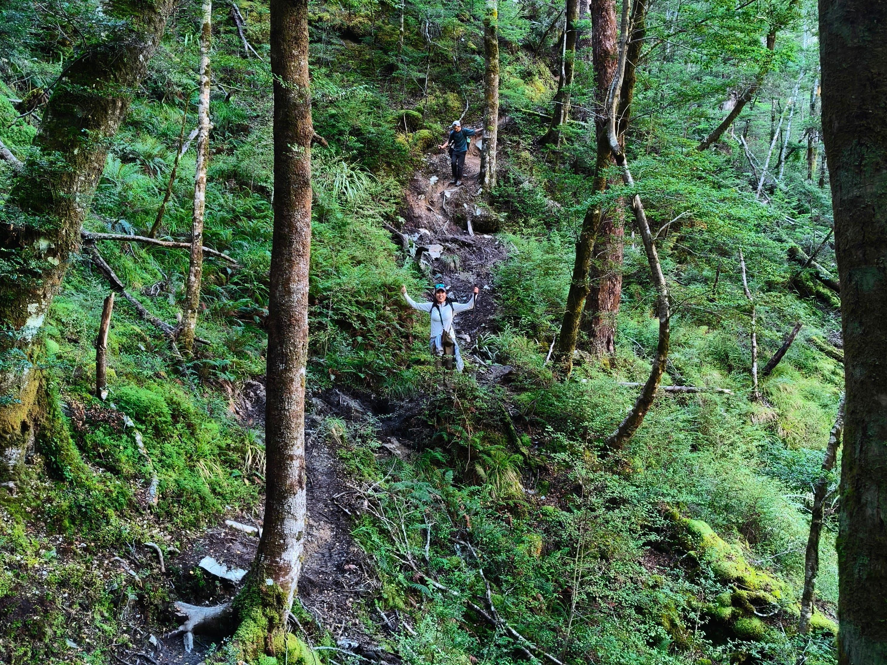
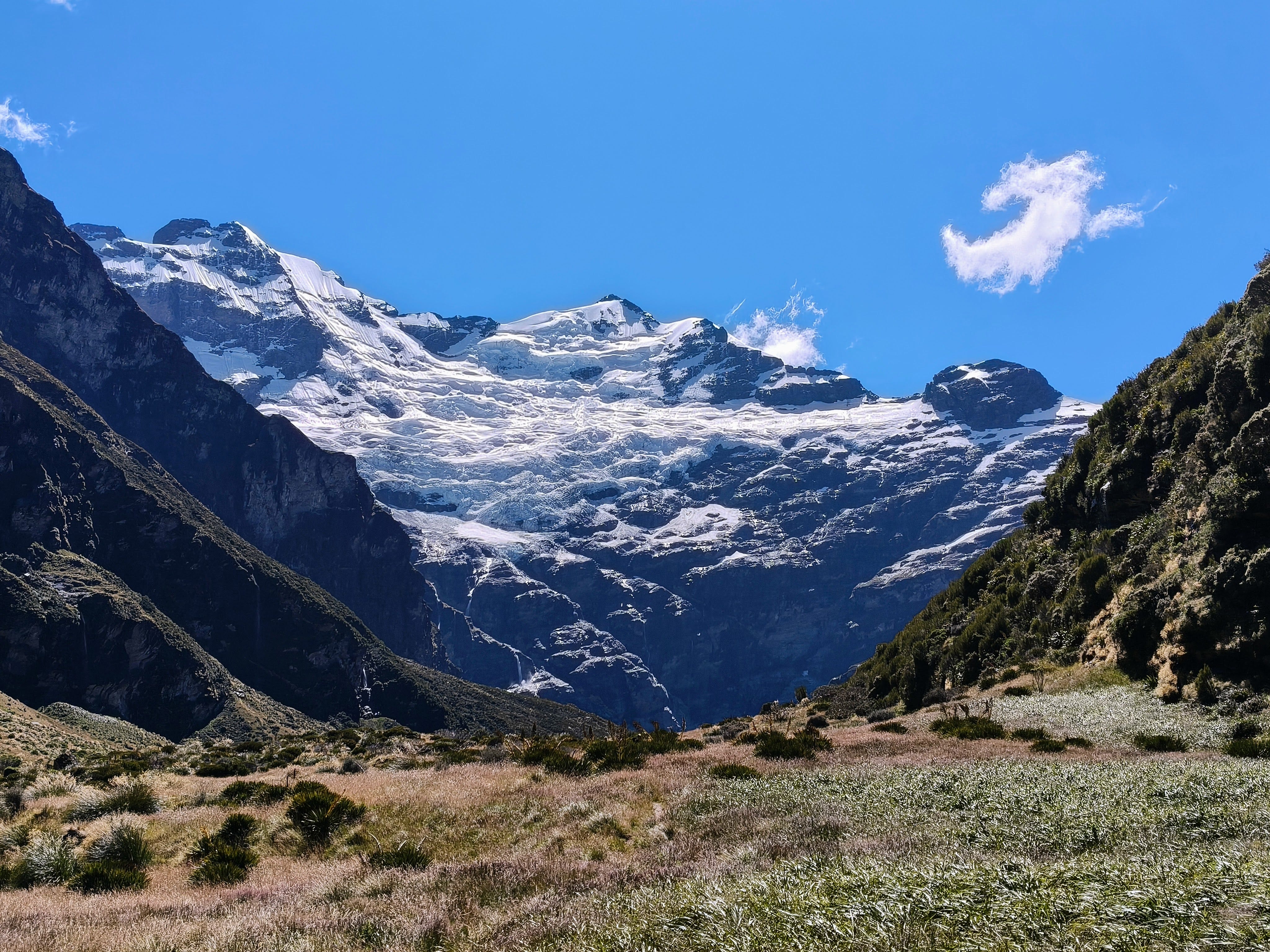
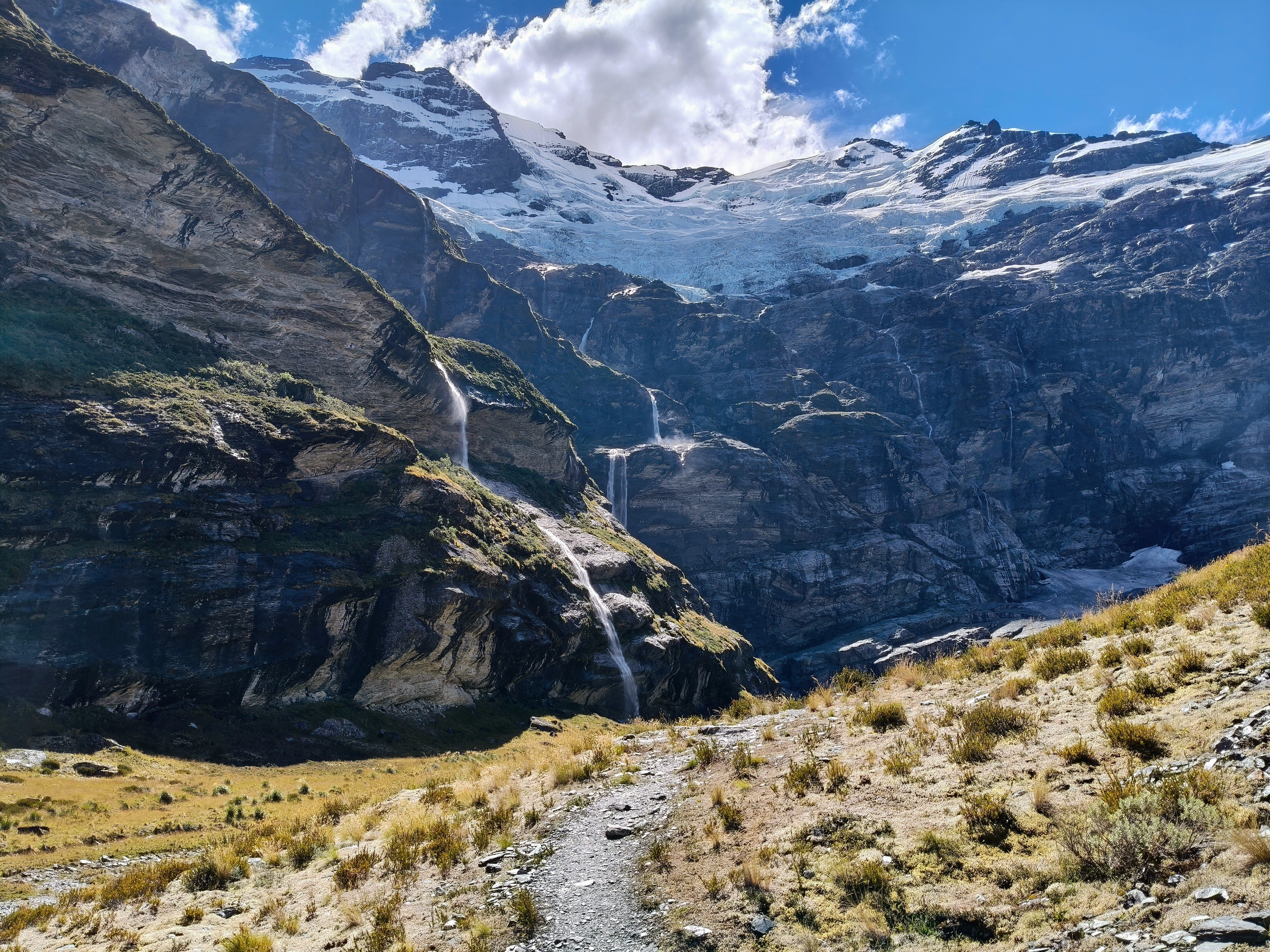
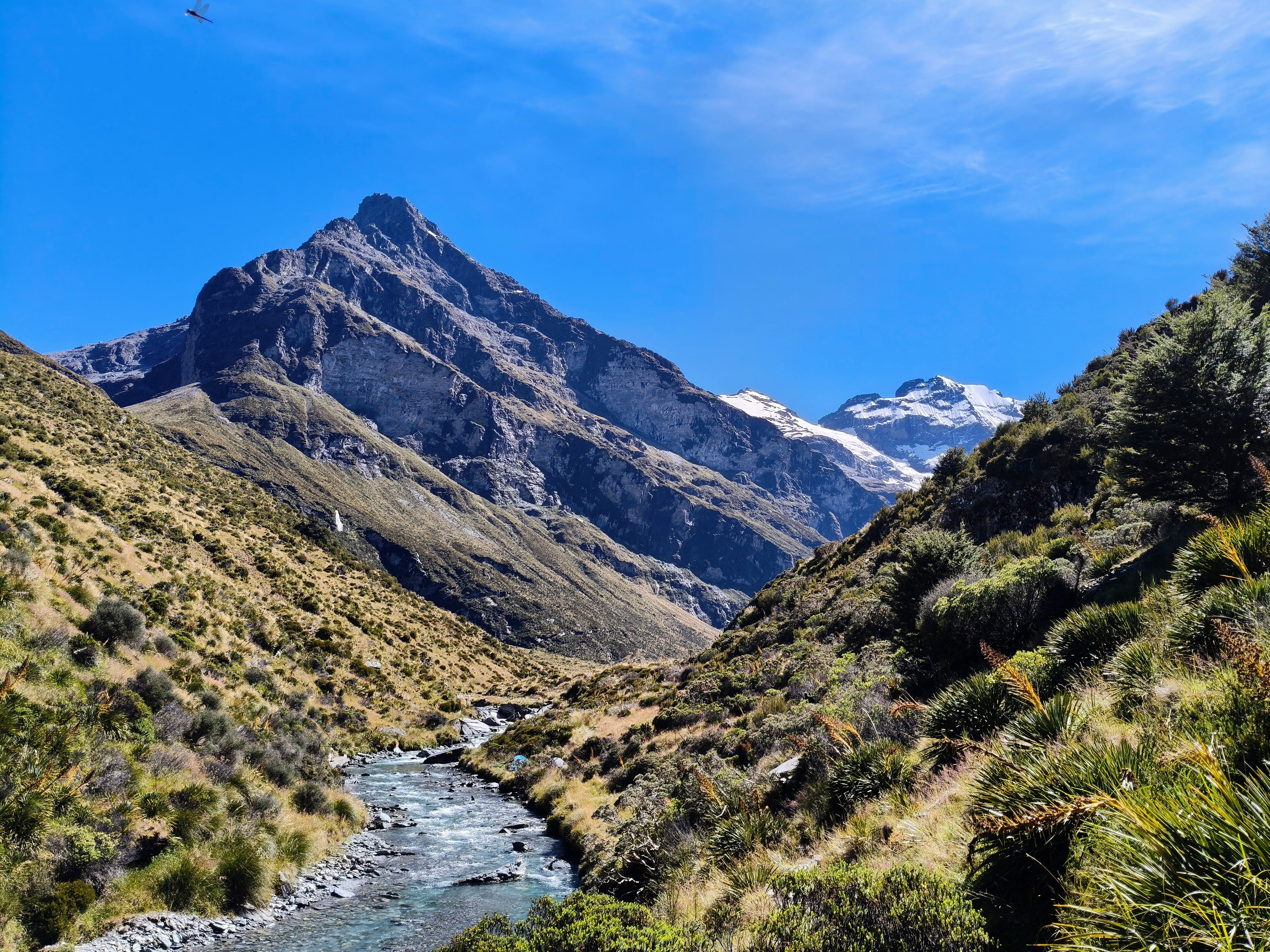
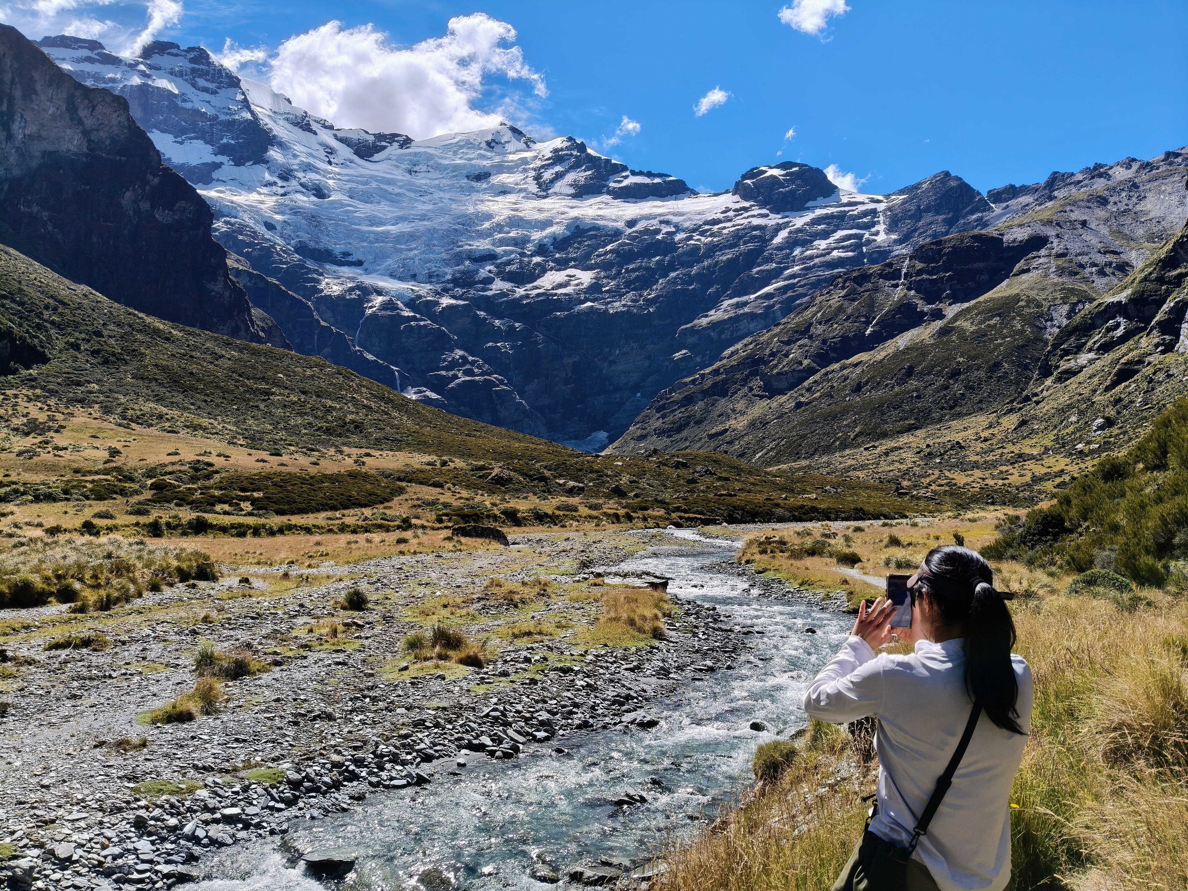
Below the treeline, in the forest, is the track. Beginning at the end of Lovers Leap Road, off the Glenorchy-Paradise Road, it weaves, mostly on Department Of Conservation land, up the valley, offering only limited views of the Burn itself and demanding a workload from those who dare tread its root-lined pathway. After four hours, more for some, the officially marked track ends and trampers emerge from the trees to views up a tussock-filled valley, with the blocky summit of Turret Head leering high above. It’s quite a sight, but you’re nowhere near done. A pathway worn between the tussocks and through bogs continues across private land and leads around the corner to reveal powerful and dramatic views of Mount Earnslaw and its giant hanging glacier. You may then continue up the valley, apparently on a crash course with the glacier.
Where it all ends seems to lack consensus. My go-to, the NZ Topo 50, shows the DOC track in the forest, but avoids indicating any route beyond the tree line3. Open Maps is a little more open to the fact there is a well-trodden track out of the trees, then places the finish at the Gilkison Falls Viewpoint. In reality, you can continue on a few minutes even from there to reach a part of the glacier up-close on the valley floor.
Where you finish is your choice. Two out of three in our party made it to the glacier, while the third had a nap in the comfy tussock, beside the burn. Everyone had a great day out.
Main Question 2: Should we hike Earnslaw Burn in one day or spend the night up there and take two?
Our journey to the glacier and back measured in at a smidge above 29 kilometres4 and took us around 12.5 hours. Those not perturbed by a long day on the feet will be able to hike Earnslaw Burn Track all the way to the glacier and back in one long day; those more keen on taking life easy and stopping to see all-the-things, plus its extended family, will prefer to slow up, take some camping gear and enjoy a night in the wild under the canvas5.
If you’re struggling to make a decision, like I do with just about anything, here’s a handy quick mind-maker-upper:
Reasons to hike Earnslaw Burn in one day:
- It only takes one day;
- You can pack light, move fast;
- More time in the region to go explore the Greenstone, Routeburn, Cascade Saddle, Mt McIntosh, Wāwāhi Waka, Moonlight, Wye Creek or whatever else you fancy doing;
- Space is at a premium and the suitable campsites beside Earnslaw Burn can get busy - no one knows how many suitable-but-unused toilet locations remain in the area;
- You only need to know the weather forecast for a single day6;
Reasons to camp overnight beside Earnslaw Burn:
- You can start at a slightly more leisurely time than 7am;
- You can enjoy the rooty, muddy and undulating hike through the forest section at your own pace - plenty of time for crying, while sat on that log;
- A chance to see and photograph the glacier at different times of the day. The sun will be right behind the glacier in the middle of the day, when most day-trampers will be arriving. A sleepover will provide a chance to photo it first thing in the morning, last thing at night or even both;
- You might make new friends among the hoards of other campers up there, or, better still, meet a Hobbit7;
- Claim bragging rights for sleeping in this wholly unique location.
How was Earnslaw Burn Track to hike?
Earnslaw Burn Track is a one-day epic, with two acts and a multitude of settings. The first act takes you up between the beech, across knobbly roots and around large tree falls. The stock standard orange track markers sit on the trees and point the way, although there were two occasions on the way up we found ourselves on alternative tracks. Fortunately, these still led back to the correct way and we rejoined the track in front of other hikers, as if nothing had happened.
There aren’t a huge number of viewpoint opportunities in this first act. A view back towards Mt Alfred and part of Diamond Lake is possible from an early clearing. The track also meets the Burn’s gorge a couple of times, briefly allowing glimpses of the running water below and some of the surrounding hillscapes.
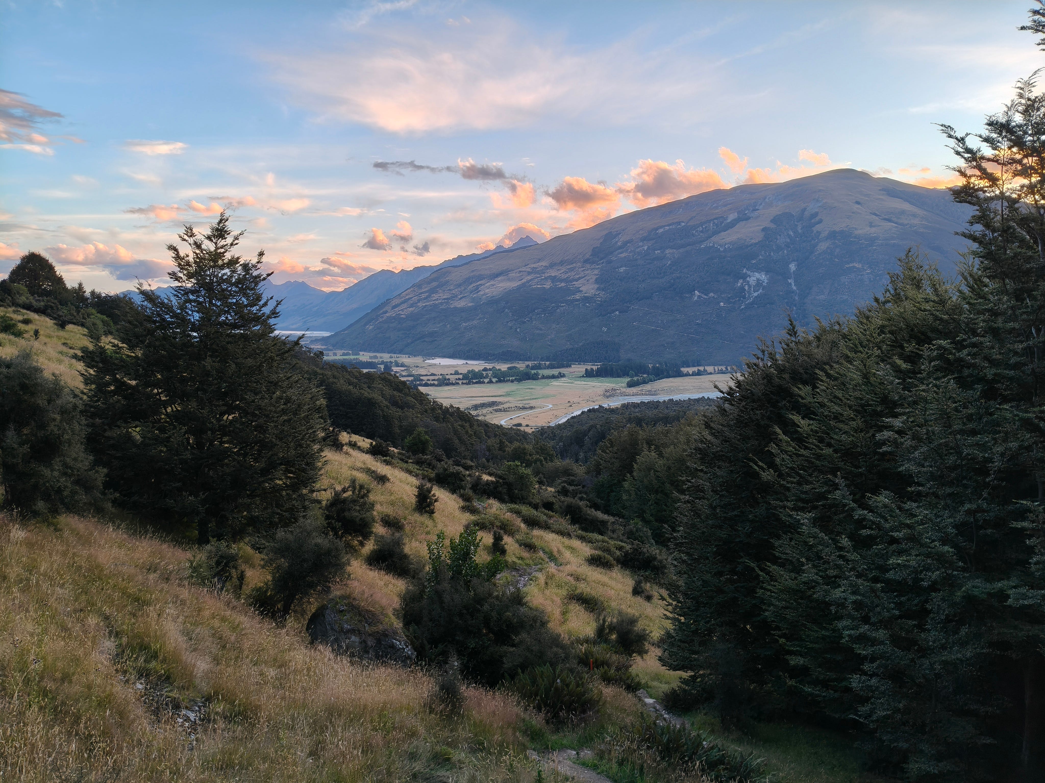
The second act is where things start to get really interesting, with the trees giving way to a large, grassy expanse upon the Burn’s flat upper valley. Tussocks and mountain scrub inhabit the plains, while rocky peaks and the glacier itself dramatise the view towards the skyline. People also become more visible with the lapse in trees, while helicopters buzz overheard and deliver yet more humans as cargo.
There’s no denying the sight of the glacier clinging to the side of the mountain is unique and awe-inspiring, precisely what earned it its social media celeb status. Yet, fame’s price in this case that appears to be a mass addition of foot traffic. Seasoned scene-seekers will fit right in, but those after true backcountry solace will be better off avoiding this on weekends and in holidays.
Yes, I know VIP is therefore an incorrect term
That and something from the final season of Stranger Things
It exists, but is unmarked and across private land
Yeah, upon going back to my Strava, it appears my GPS watch did a bit of overcounting up top
I know, not many hikers will be taking canvas tents - its just a figure of speech, okay?
Though, it probably pays to check nothing gnarly is brewing in the following 48 hours
Or Gollum. So beware.
amazing