
My Top 10 tracks of 2025
Of all the tracks that touched my soles this year, here are my ten favourites.

2025, what a year! We have to say that, don’t we? I don’t know why, but something about the 31st December has us stepping back from the giant annual mural, placing hands on hips, head cocked slightly upwards, as we remark “what a year!”
What a year!
For no reason other than it might be useful or interesting to some, here are my top 10 from the bunch of tracks I walked on these past twelve months. As usual, share your thoughts.
10. Tunnel Point, via Gibbons Track, Muir Track and Pararaha Valley Track - Waitākere Ranges, Auckland
For a year that’s been spent 90% in the Supercity, you can sure bet there’s going to be some Auckland tracks on the list, but these aren’t just here to make up the numbers. Follow this well-graded route from Whatipū car park and campground up the spur into the southwestern corner of the Waitākere Ranges. Enjoy vast views of the former Taranaki Bay coastline, now swamped in black sand wetland, as you follow the level ridgeline, before dropping down into the lush, nīkau-friendly Pararaha Valley - site of a former kauri logging settlement. A short calf-workout through the dunes delivers you to Tunnel Point Campground - perhaps the most isolated spot in all of mainland Tāmaki Makaurau - named for the tram tunnel blasted through the rock, which survives to this day. Spend the night and/or return along the wild Whatipū Beach. Alternatively, you can walk down from Karekare Beach and it’s a lot faster and easier - turns out this is what we actually did this year!
9. Ernies Track, Hunua Ranges, Auckland
The kauri dieback prevention work and subsequent sanitisation of the Waitākere Ranges has left many serious trampers craving a Sunday saunter that tests. To my surprise, its sibling range to the southeast contains a bunch of tracks that are no pushover. To reach Ernies, park at the Upper Mangatāwhiri Dam and follow the gravel Waterline Road beside the lake for a couple of kilometres to the junction with Ernies. There the challenge begins, with a muddy, undulating stretch through bush and over some bridges and boardwalks. Cross the Mangatāwhiri River, pass through an unusual copse of bamboo and begin the climb up towards pt. 497. Several views make themselves known, including one from a bench at the summit and another from a bench further on. The last treasure on this jaunt is the cool little Piggotts Hut, which sits where the track meets Lilburne Road. The road leads back down the hill to the dam and car park.
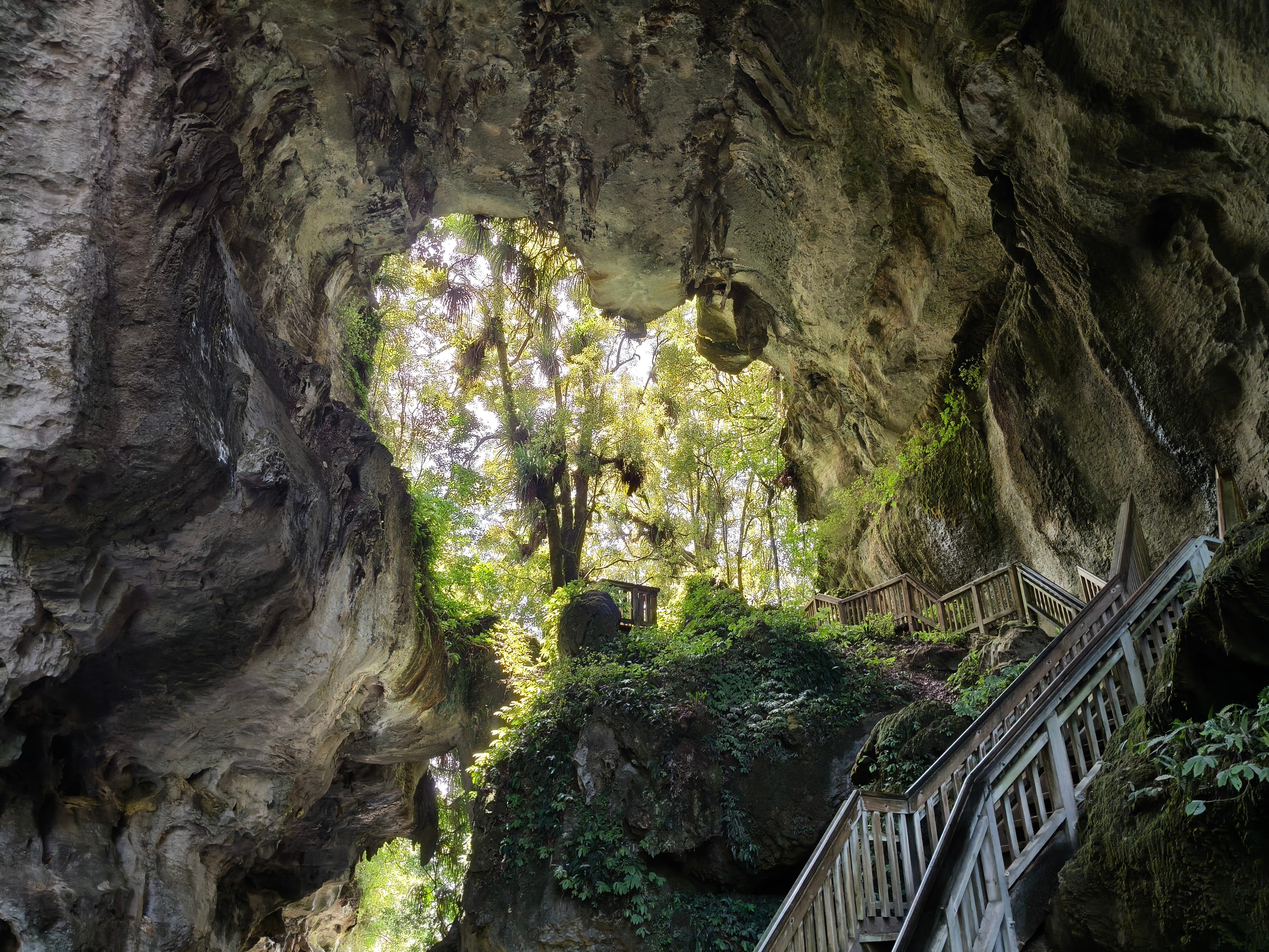
8. Mangapohue Natural Bridge Walk, Piripiri, Waikato
This is easily one of the North Island’s most impressive, but little-known, natural wonders. The Mangapohue Natural Bridge asks of visitors to complete a very short walk, in return, rewarding them with an impressive limestone gorge and a 17-metre high naturally formed bridge, towering overhead. No longer a loop, this is probably the easiest track to make my list, but the bridge itself is truly impressive and is far enough from the beaten track that it might come with a decent slice of quiet time.
7. Bell Track, Pirongia Forest Park, Waikato
Of all the ways up and down Pirongia, Bell Track has always been the most eventful to me. It has Pūāwhē (previously named The Cone), with its epic views to the northwest of Whaingaroa Raglan; on a corner shortly afterwards werewere-kōkako (NZ blue mushroom) like to grow; the track then gently descends through forest to Central Clearing campsite, offering a large open area and stream water to make your camp coffee with; kahikatea then becomes the star of the show - a 66 metre tall white pine, the tallest native tree in the country, is reachable up a side track immediately after a bridge. It’s a big day, but a memorable way to descend from the mountain’s Pāhautea Hut. (My nephew was born, as I hiked Bell Track in 2021.)
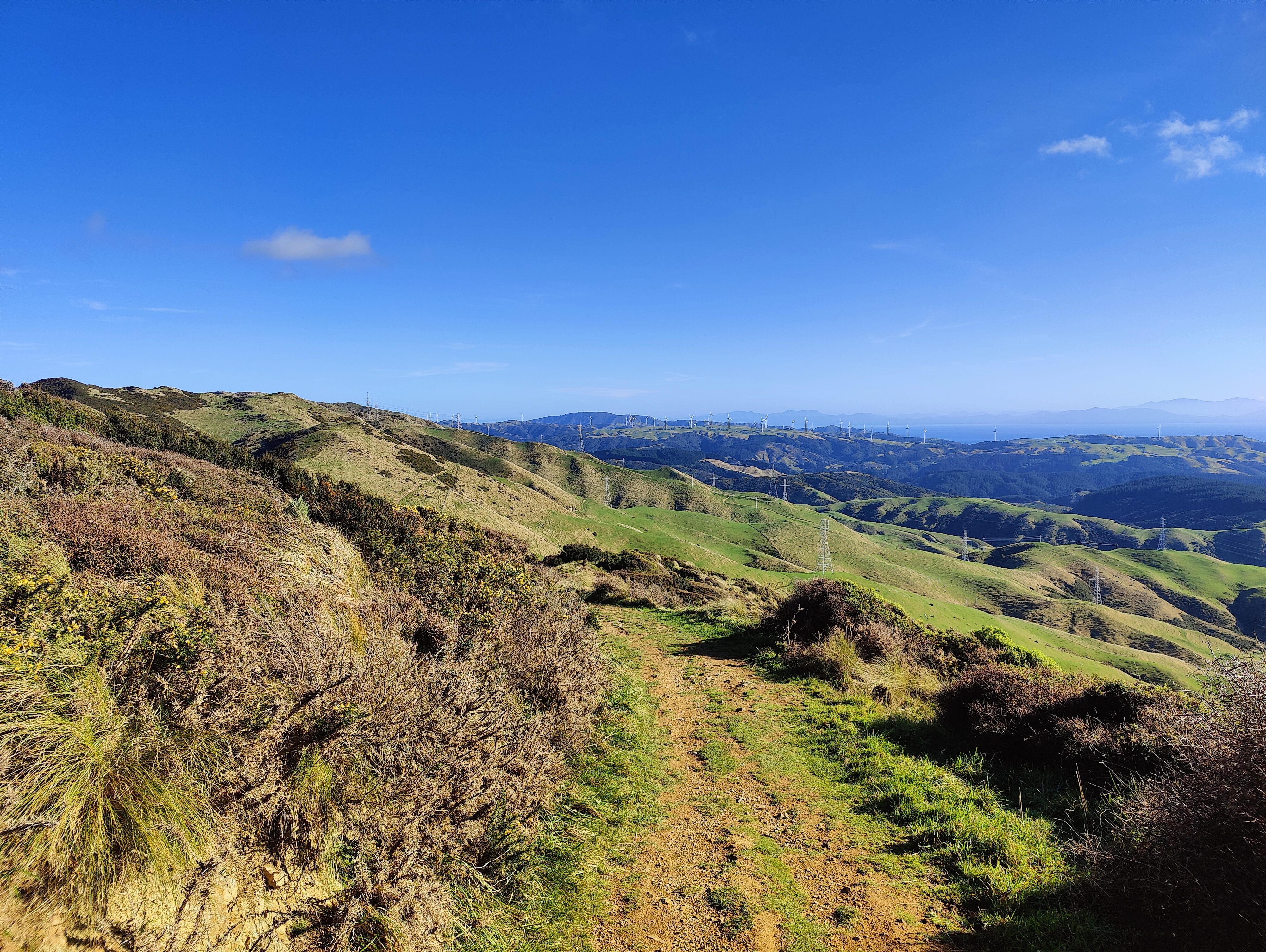
6. Skyline Walkway, Wellington
No gondolas, no luge, just a track that traverses part of those huge hills that loom over the Wellington skyline. Ah, skyline, I just got why it’s called that! Take a train from the city centre up to Johnsonville - a rail trip that feels at times like it’s borrowed its track plan from the Trans-Mongolian, the way it snakes gradually up the incline and the opposite end of the train frequently pops into view. Once on foot, wiggle through suburbia, up Cortina Avenue (I saw none) and left on Flinders Place to join the walkway. The wide, shared-use track then undulates its way along the ridge, soon arriving at the wooden viewing platform beside Mt Kaukau. The route then continues on its up-down path, allowing the city and harbour to boast its views (on a good day), eventually arriving at Johnstone Hill. Here I dropped down into Karori, wiggled through a short bush track by Zealandia, before jumping on a bus back to meet a friend for wine in Newtown. You can continue right through to Makara Hill
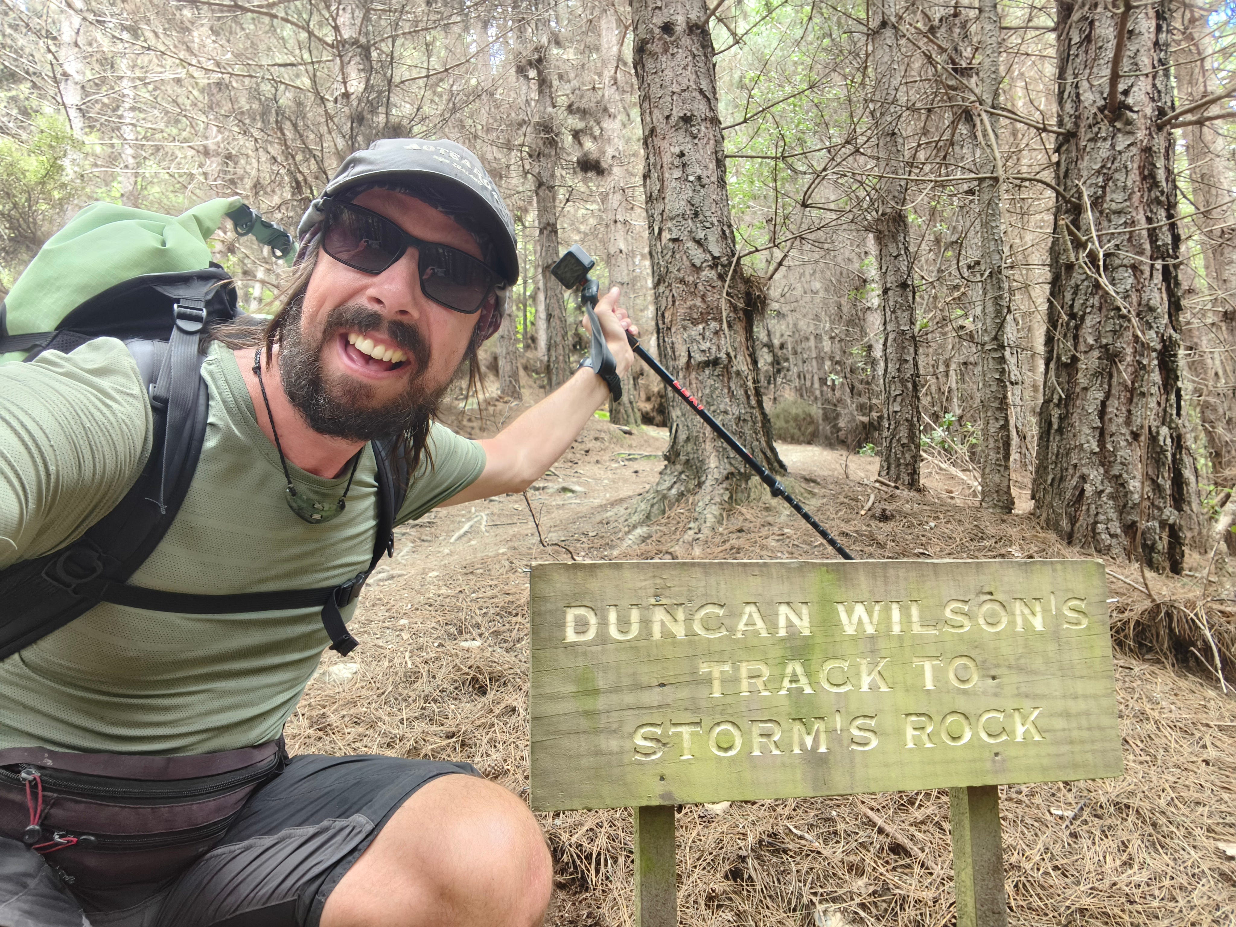
5. Duncan Wilson’s Track, Queenstown, Ōtākou
There’s a track with my name on it and it has nothing to do with me. That said, this is my list and I’ll include what I want. From Wilson Bay, on the shores of Whakatipu, take Seven Mile Point Track until a junction offers you a right turn up Duncan Wilson’s Track to Storm’s Rock. It’s a short one, taking approximately 3 minutes to reach the rock, but what a rock! Thank you, Storm, good find. The views across Lake Wakatipu are stunning and worth the minor detour. Whoever Duncan Wilson is/was, salute that man.
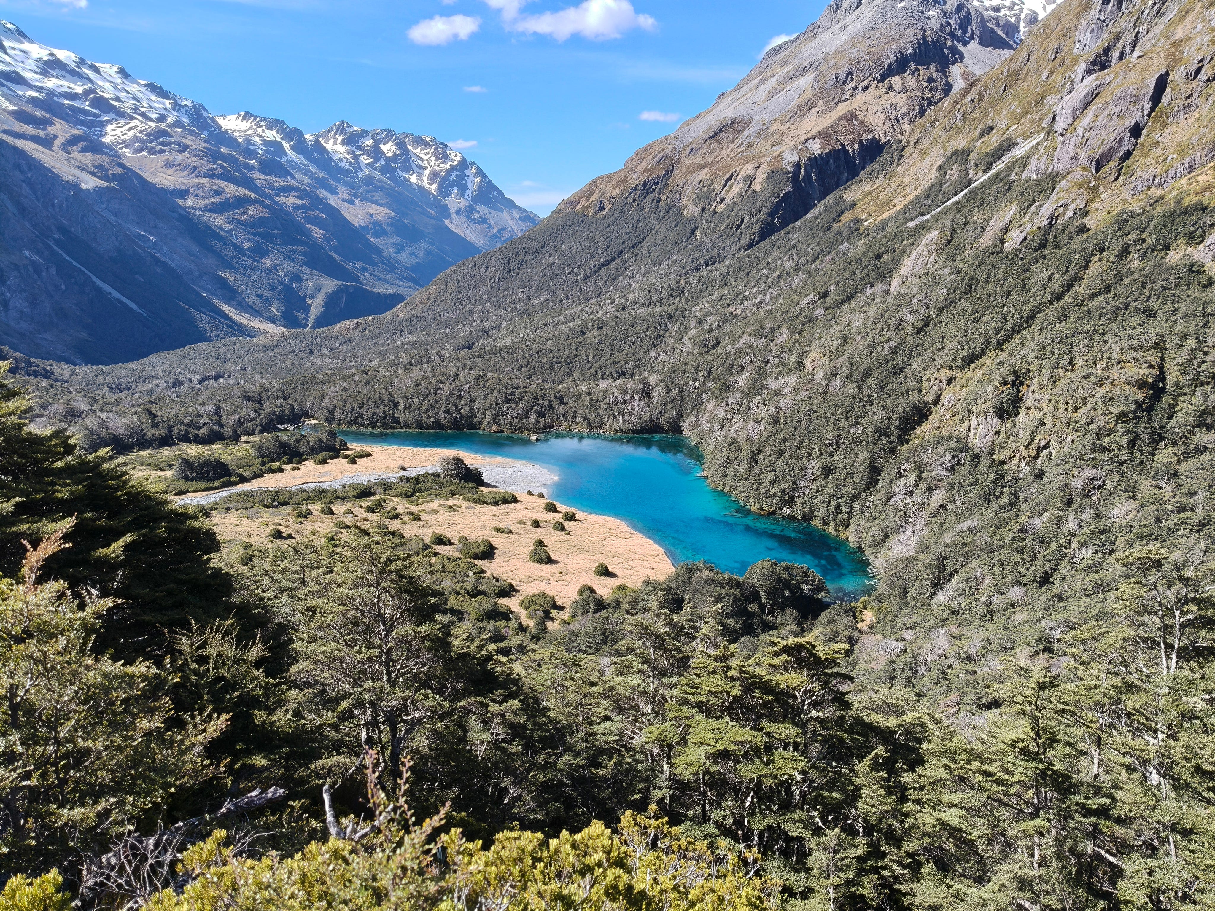
4. Waiau Pass Route, to Blue Lake, Nelson Lakes National Park, Tasman District
They say “it’s about the journey, not the destination” and that’s why this is a list of tracks and not destinations. However, an exception to that has to be the side quest on the Travers - Sabine Circuit that leads up to Rotomairewhenua Blue Lake. Holding officially the clearest water in world, it’s hard for the tracks heading to such a natural wonder to be anything more than a pilgrimage sidekick. Still, Nelson Lakes National Park is an eye-opening place, with a variety of stunning route options towards Waiau Pass Route, where this magic roto is found. I started my pilgrimage on Mt Robert Road, beside Rotoiti and took Lakeside Track, Lower Travers Valley Track, Cascade Track, Mt Cedric Route and Sabine Track to join with the Waiau Pass Route. This provided a stunning mix of riverside valley and alpine travel. It crossed over hard, compacted snow and through potential avalanche zones, beside the clear, blue Sabine River - which runs out of the Blue Lake. Rotomairewhenua / Blue Lake has the clearest water in the world and it must be seen, go there.
3. Trounson Kauri Park Loop Track, Northland
“I’ve been coming here for years. I’ve sat out in those bushes for hours on end. I don’t think there’s many kiwi in there. I once sat for an hour listening to some rustling close by, only to find myself face-to-face with a possum!”
I’m not entirely sure how much my pep talk to fellow campers affected their decision to take the night kiwi bird walk at Trounson, but Zoe and I still went out for a look. This is a breezy, 30-minute loop through part of an ancient kauri stand on the edge of the famous Waipoua Forest. The giant kauri trees are magnificent and worth every bit a look during the day, however at night the sound of the kiwi call takes over. Grab a red-light and set off from the brilliant Trounson Kauri Park campground (DOC campsite pass enabled + hot showers = amazing) and follow the easy gravel and boardwalk trail round. Walk gently and quietly and listen out for the calls and any rustling in the low foliage. We did this, pausing to listen when we heard a noise, which turned out to a be a North Island Brown kiwi. Whether the population density has increased since I last looked or we just got lucky, I’ve now updated the “odds of seeing a kiwi bird in the wild” to: high.
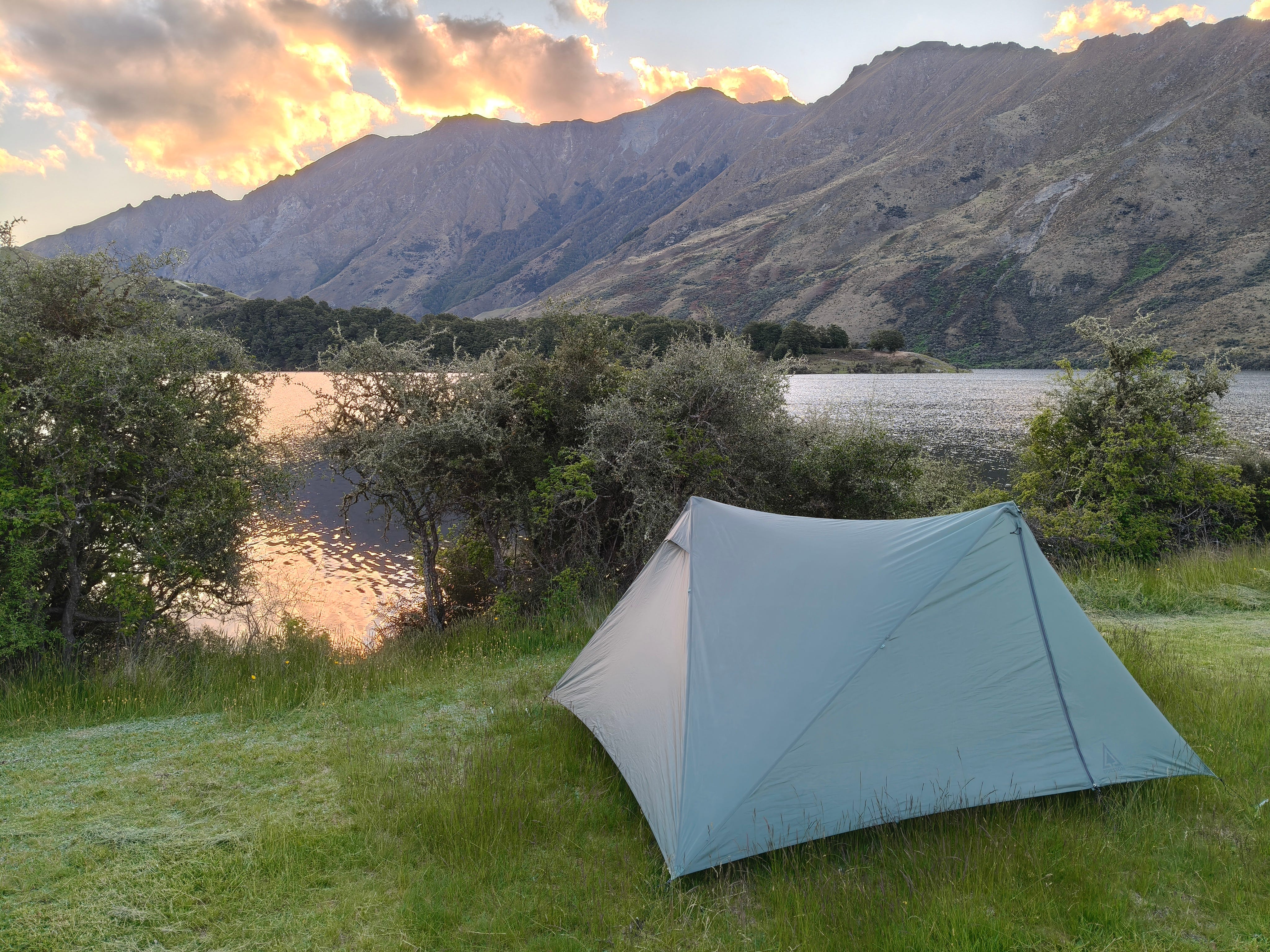
2. Moonlight Track, Queenstown, Ōtākou
Follow Moonlight Track at dusk, on a clear night from Moke Lake Campground and you might see why it got its name. Head up Gorge Road from Queenstown to Arthurs Point, however, and you’ll be heading in the opposite direction - like I did. It’s still a great track, however, and offers hikers of all abilities the opportunity to view some truly rugged and mountainous wild country, without stepping too far out of town. Take McChesney Road (the one and only) and join Moonlight Track (the road) until it becomes Moonlight Track (the track). It soon opens up to views of the Shotover Gorge, north towards Skippers and the Southern Alps. Officially, the track now follows the gravel farm road through to Moke Lake, but the more adventurous types should take the ‘old road’ beside Moke Creek and enjoy its tunnel section and multiple wet feet crossings. Usual river safety sense should apply. Take a tent and spend a night or two at Moke Lake camp for the full experience.
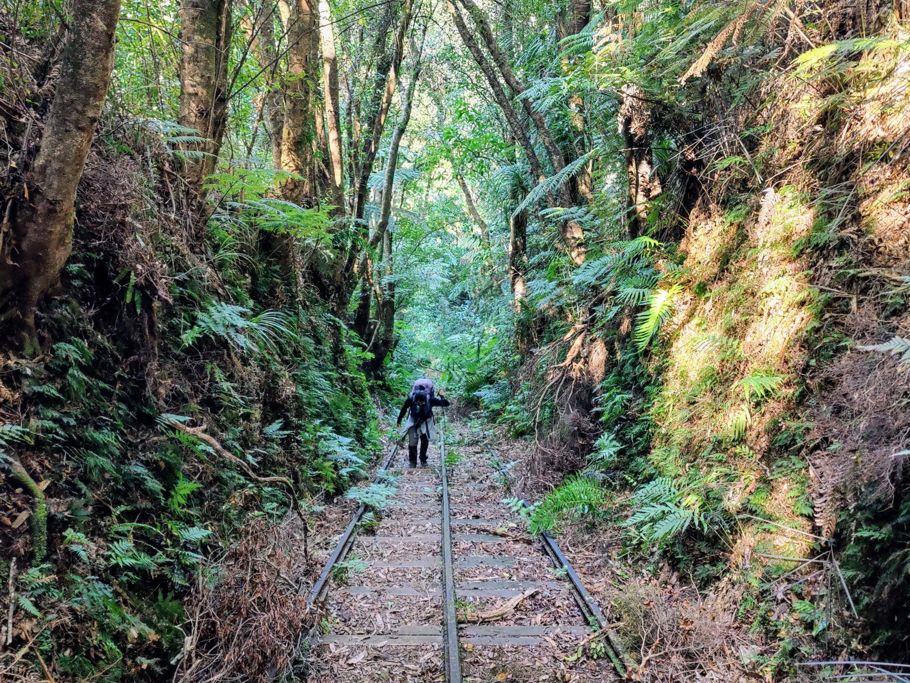
1. Waiorongomai Valley, Te Aroha, Waikato
Pleasant surprises can make all the difference between a good track and an amazing track when out tramping, so meet the Piako County Railway, up the Waiorongomai Valley, in northeast Waikato. Containing a plethora of pack tracks and rail lines from the gold mining days, you can make up your own route up to the ridge behind Te Aroha Maunga. Some of the tracks follow the steep rail inclines, where the majority of rails still sit or have been refurbished, and take you past other old gold infrastructure. We walked this area in amazement at the recent history still lingering. An old miner’s tunnel provides a link to Te Aroha Link Track and then you can take Waipapa Track down into the Waitawheta Valley and spend a night at the hut (recommend not weekends/school holidays, as it’s a favourite for families). Allow a day each way to reach the hut and enjoy all in that valley that deserves to be looked at.
So, there’s my ten. Have you done any of these? Do you have any recommendations for 2026? Has 2025 been a goodie? Here’s to 2026. What a year.