
Rolling round Ernie's Track in the Hunua Ranges
How a single hike changed my mind about the Waitākere Ranges' southern cousin.

With the urgent and necessary iwi and council action to address kauri dieback disease in the Waitākere Ranges comes a common complaint: “it’s no longer tramping”. Leveling all the tracks and compressing them with gravel has squeezed the true challenge from them. And those are the tracks that have been remedied and reopened. Hardcore, off-road tramping gems like RGB and Simla have been shuttered, never again to test a person’s knee with their slippery mud and insane gradients.
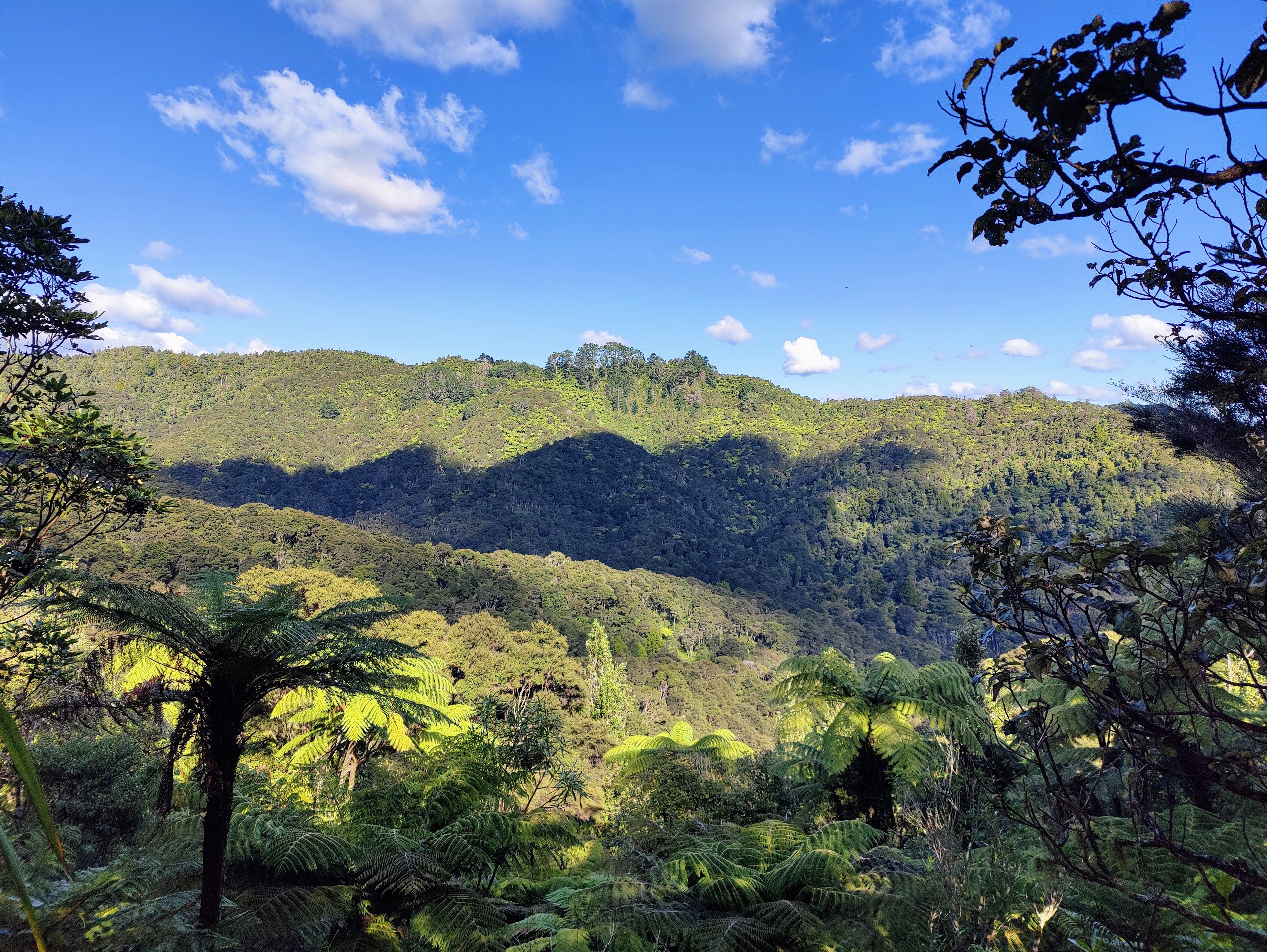
Enter: Hunua Ranges. Once, to my mind at least, the poor tramping cousin to the Waitaks. Crawling with gravel roads, largely regenerating native bush and minus the black sand coastal vistas of its western counterpart, the Hunuas always lacked that last magical 10%.
That was the former opinion of this very compromised west coast fan. However, here's how that changed after a recent day out on Ernies Track.

“Ernies Loop - 5-6 hours. Do you have enough time, water/snacks, fitness to complete this today?” warned a sign, passively. We scrubbed our boots and marched on, although a little piece of me did question if we did.
To get to Ernies, you have the simple task of walking a few of kilometres along a gravel road, which weaves its way along the shores of the Upper Mangatāwhiri Reservoir. On our bluebird day, the artificial lake glistened between the trunks of the ponga and kānuka that line its shores.
As we powered along the road towards the junction with the track, a cluster of boisterous yelps and screams were getting louder. A lone woman stood at the trail sign, as if posted there by her superior. We trundled past, our speed initially undeterred by the change in terrain; carefully laid chips of gravel were instantly swapped out with pockets of slip-slidey mud.
The noises were getting louder and we soon caught up with the emitters. A small bridge over a stream provided a brief respite from the mud. As we crossed, a long train of teenage boys was slipping and sliding through the mud just ahead on the track. They playfully mocked one another for every wrong-footing. As we neared them, one of the boys at the back turned and said “Hi, Sir!” before instructing his friends to let us overtake. As we passed, he spoke in Mandarin to one of his mates. Zoe later translated this as him realising: “He’s not our teacher, is he?”
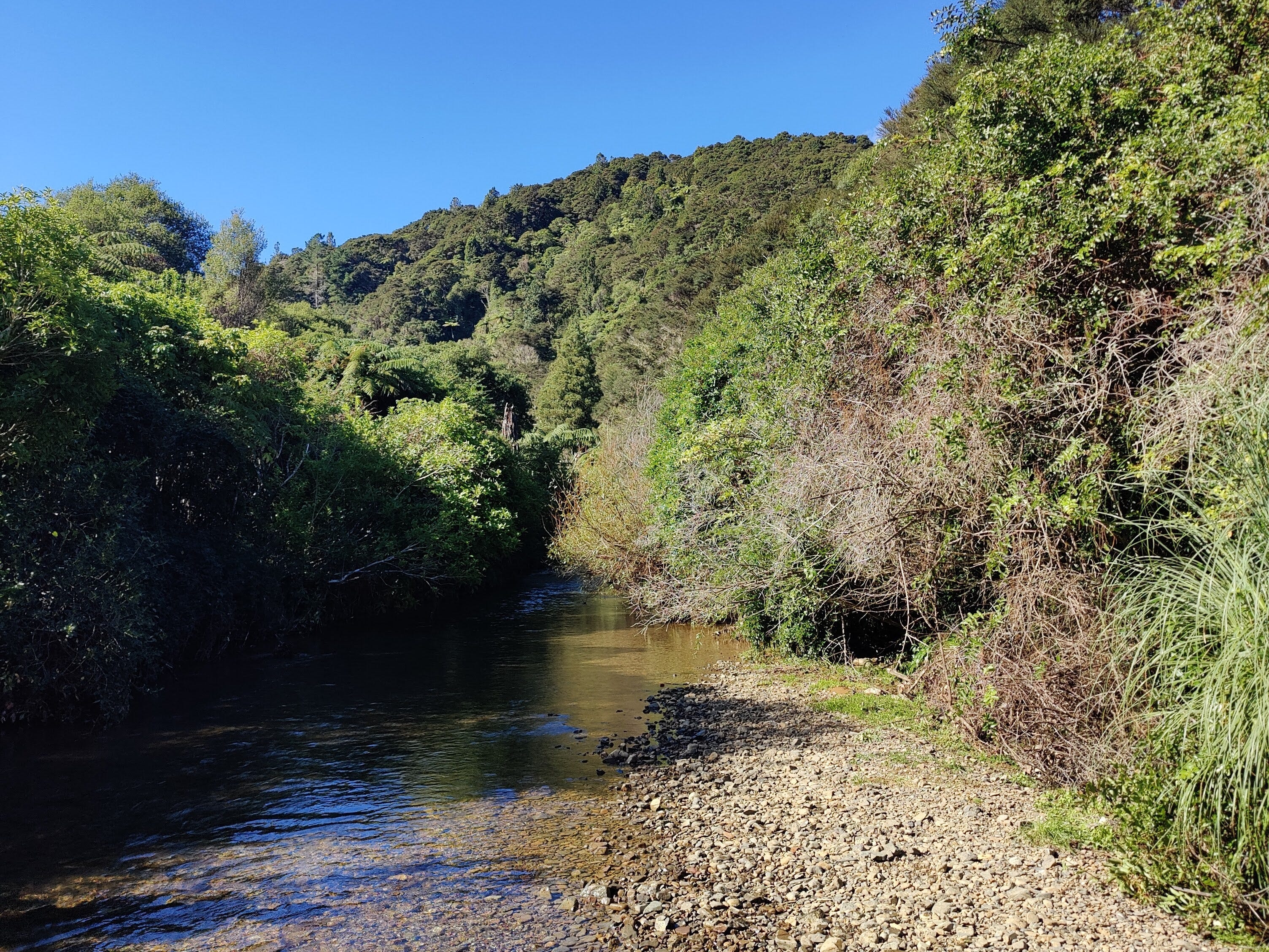
I wasn’t, but there were more teachers dotted along the trail. We overtook several more groups of young people, each one burdened with a large pack, before arriving at the shores of the Mangatāwhiri River. On the pebbly beach sat another lone woman, reading her book on a fold-up chair. She confirmed she was a teacher, stationed there to ensure no student tried to cross the river in the wrong place. This was useful info and may have prevented us from crossing the river in the wrong place.
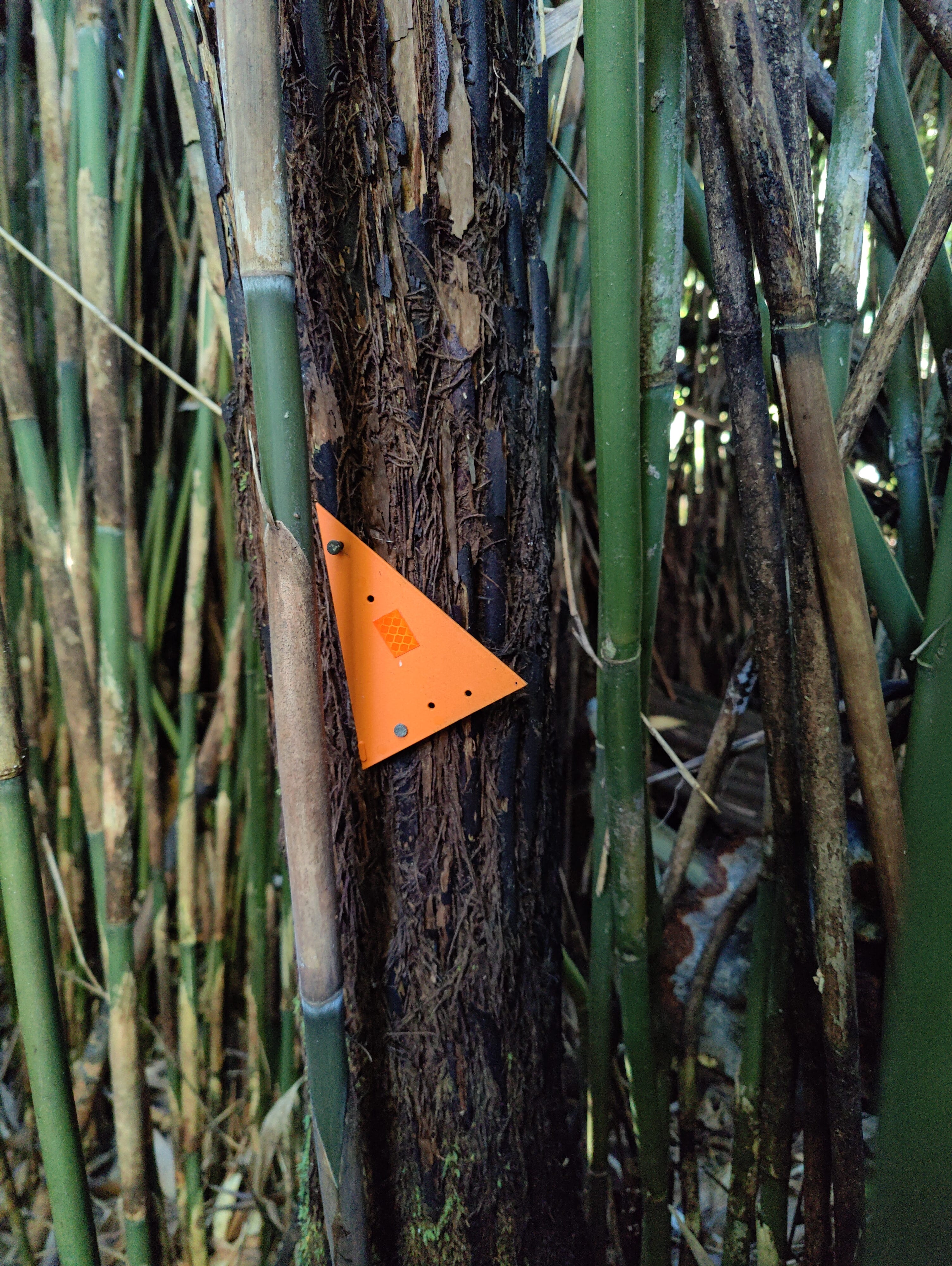
Shortly after crossing the river in the right place, an orange track badge pointed us through the middle of a small bamboo copse. You know, that exceedingly common native plant of Aotearoa: Bambusoideae. A surprising species to see inside the native bush at a regional park, but a clear hint at the area’s recent history.
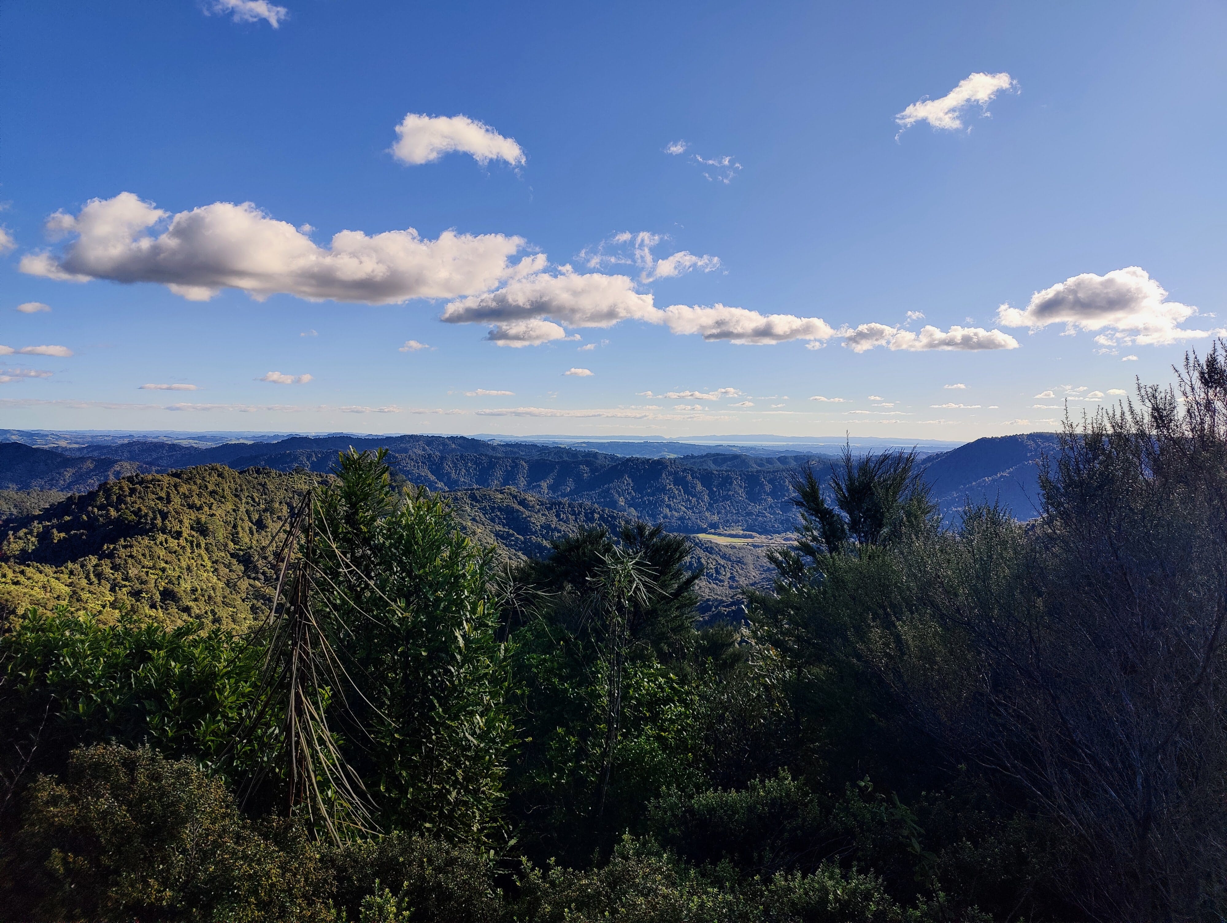
A lengthy and steep climb followed, during which we passed several more groups of teens. Some were doing the loop anti-clockwise, gripping trees and trying not to slide too far as we paused to give way to them. A pair of teachers waited by the bench at the summit, which came with a mint view back across the ranges; there are worse spots to be posted for work.
One more bench awaited and we stopped to take in some fluids, a snack and the view. At first glance, I wrongly presumed we were looking north towards the Tāmaki Strait and the islands of the Hauraki Gulf, but as I chewed on a palm-load of Proper Crisps, I realised what we were really looking at: the Manukau Harbour, the Āwhitu Peninsula and the southern end of the Waitākere Ranges. Auckland’s western playground and my old mate just popped up to say '“hi”.
Ernies is a proper tramping track, with some technical tests seldom seen in the present day Waitākere Ranges. It throws at you a river crossing, a steep ascent and plenty of slippery mud, in exchange for some decent vistas, easier boardwalk sections and a pleasant undulating section higher up. My view of the Hunua Ranges was changed forever. Within its boundaries, Aucklanders and Waikatoans can frolic through a real rugged variety of tracks, from gravel roads to muddy slop fests.
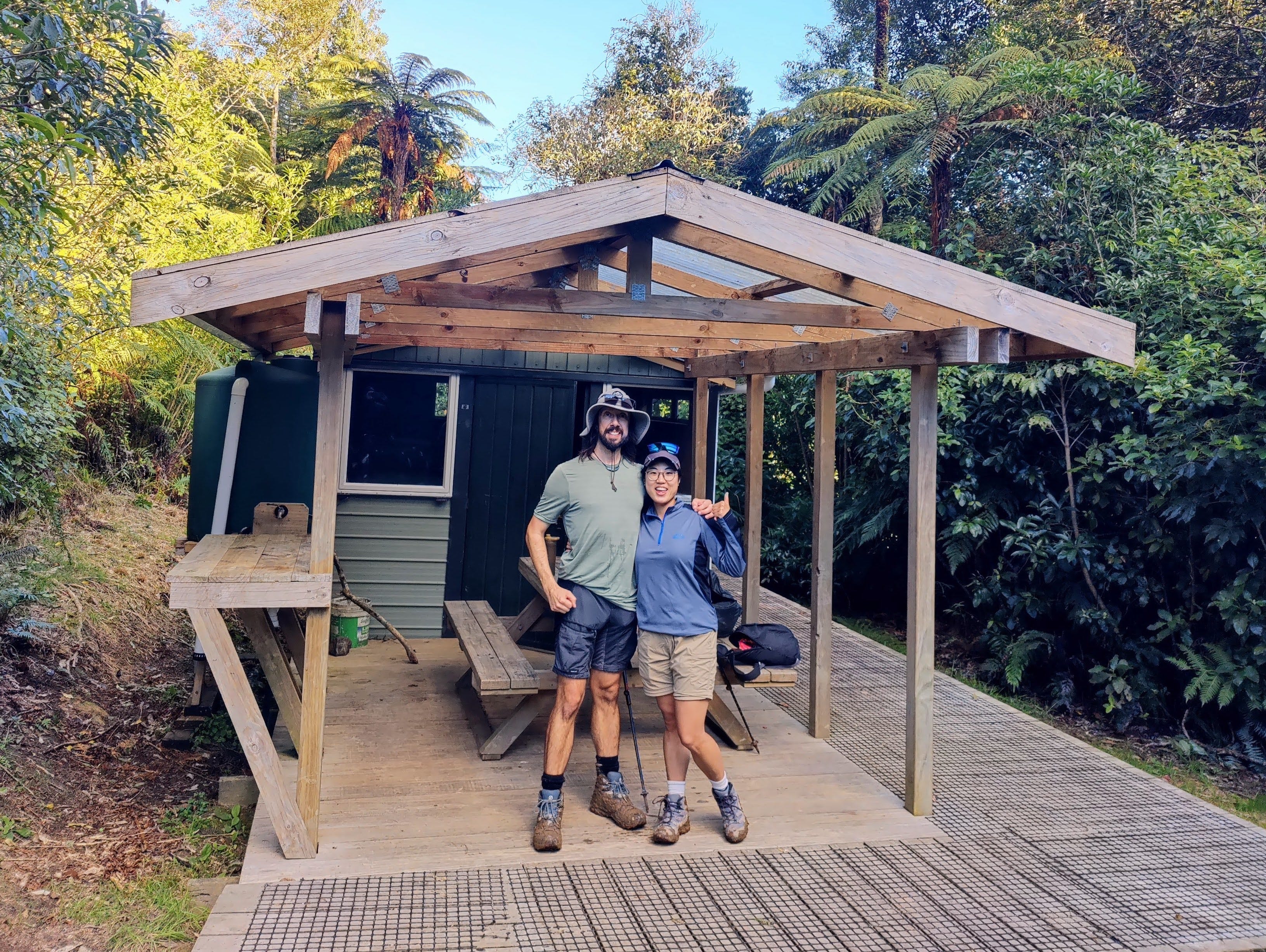
We still had one final landmark to take in: Piggotts Hut. To return to the Upper Mangatāwhiri camping area and car park, Ernies Track joins the gravelled Lilburne Road and Piggotts Hut sits right there.
A small, flat clearing beside the road makes home for what is both a campground and a hut site. The little metal bunker has four mattresses inside, with a covered deck and cooking area recently bolted onto the front. The level grassy area out front offers plenty of site options for those with canvas-inclinations, or who just missed out on a bunk.
Since it’s a junction, a lone teacher was waiting beside the track signpost and he confirmed my suspicions: the young ones were all trying for the Duke of Edinburgh Award. No other reason to carry giant packs around a one-day loop track, right?
The sun had dropped behind the trees, leaving the entire site in a sudden and chilling shade. Zoe and I sat on the bench under the shelter, breaking slabs off a giant bar of Whittaker’s chocolate. It had been the best day’s tramping in Auckland in a long time.
Then I remembered a little-known fact about this side of the Hunua Range: it’s aktshually in the Waikato Region.
But, who was Ernie?
love it