
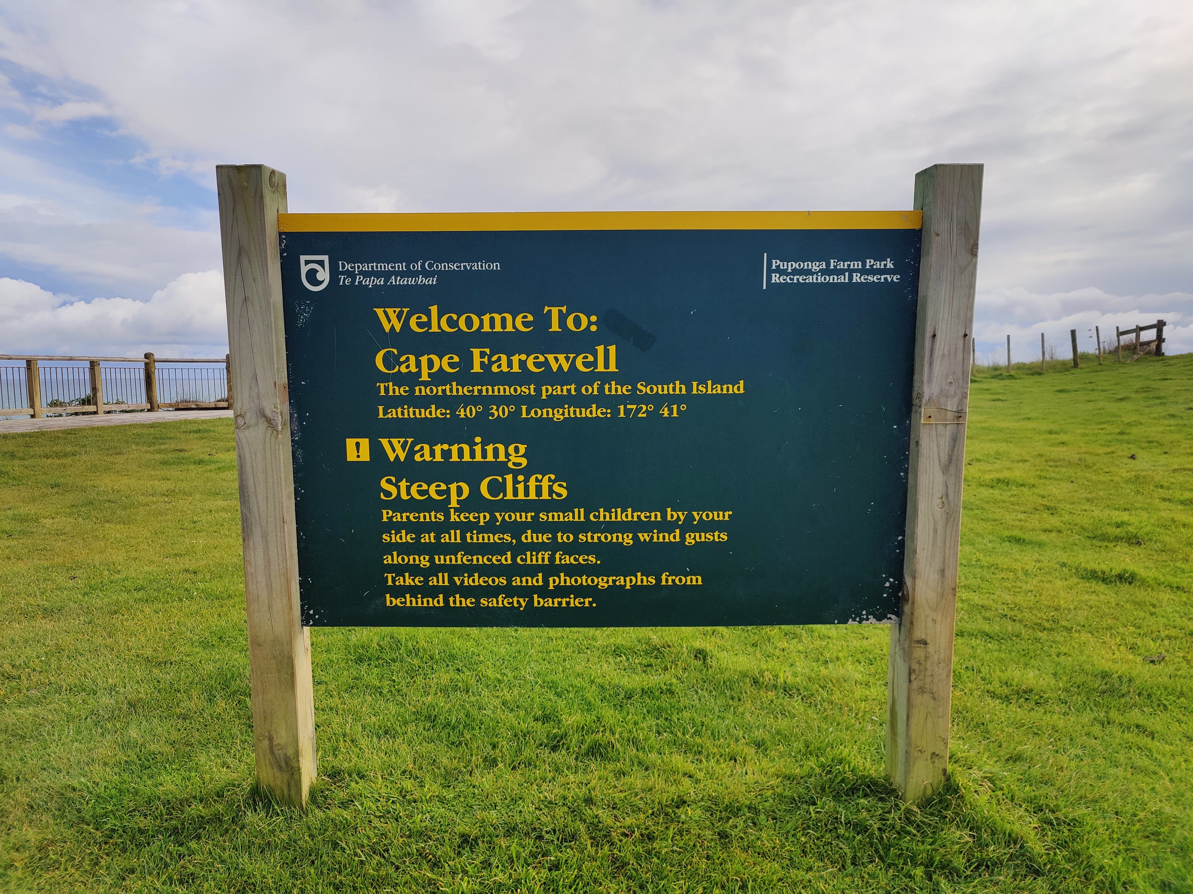
Goodbye, Cape Farewell
Day 1 of my journey across the South Island with my little blue boat. Which is actually a packraft. And I'm hiking in between. Cape Farewell to... let's see, shall we?

The mission: traverse the length of New Zealand’s South Island in my little blue boat. Actually, it’s a packraft, but for selling this adventure, it’s far more impressive to talk about carrying a boat around everywhere on one’s back. Plus, packrafters associate packrafting with smashing down whitewater rivers, nose-into-the-fizz. I see this as fundamentally different. To me, it’s a journey from A to Z, Cape Reinga to Bluff, the top to the bottom, north to south, from beginning to end. Why? Just to see if I can. Nation-length travel using just the power of paddle and foot - what a goal!
Upon waking up in my small tent at Wharariki Holiday Park, then carefully disentangling my cumbersome, gangly self from inside it, the southern goal of Bluff felt very, very far away. The activities of the early morning were front of mind: pack up and get on up to Cape Farewell at a somewhat respectable time.
Eugh, packing. Fitting a few smallish items into one large pack doesn’t seem like a tough mission on paper, but out in the literal field it always manages to surprise. I have a very rigid order in which items must be packed and a very rigid habit of always leaving one item out. Today was no exception. On the kitchen deck, I stood, while the tent and sleeping gear went in first. I then crammed my clothes and cooking gear into the gaps. Food was packed on top and I was convinced I was nearly ready, until I spotted my gas cannister, perched innocently on the wooden table.
“You numpty!” my outer monologue sighed and I started to pull the top items out to start again.
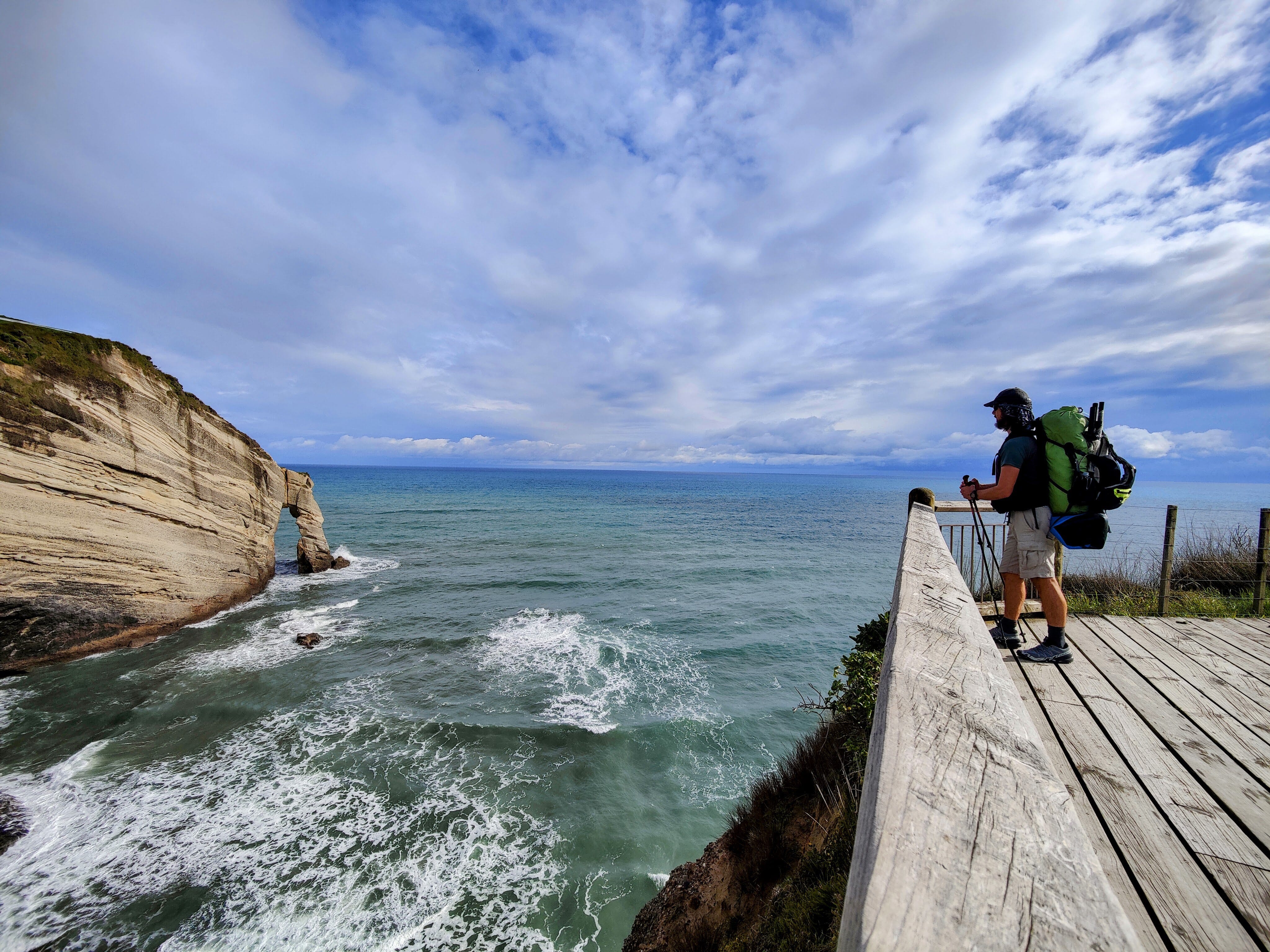
Pack finally packed, I strode out of the camp and along the kilometre or so of gravel road towards the cape. The grey-stone road snaked between lush green fields, leading me gently uphill. Mucky-bummed sheep stood, chewing grass and gawping as I, loaded like the human equivalent of a donkey, marched purposefully towards the cape’s info sign and small wooden viewing deck.
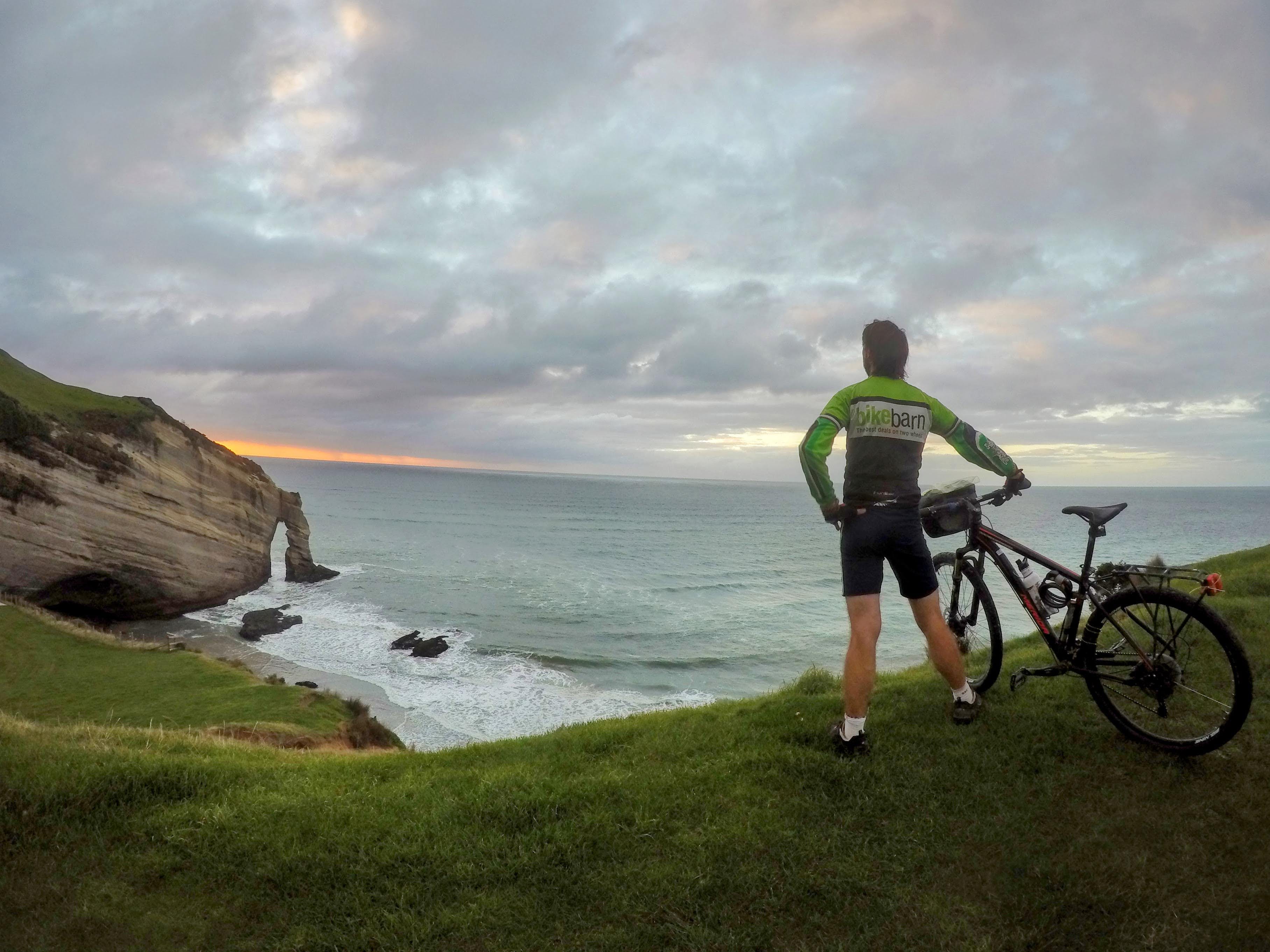
My sentimental attachment to Cape Farewell stems from my first visit, during my 2015 bike ride. All the island’s extremities were little milestones to tick off; Cape Farewell, Slope Point, East Cape, Cape Egmont and Cape Reinga each came with their own emotional package of the journey at that point. As I recall, Cape Farewell was a small comfort amidst a rollercoaster of broken - and breaking - wheel components, combined with a welcome warmth that autumn hadn’t delivered further south. Waves smash into the cape, made of the same water that laps at the nearby North Island coast and the geography in those parts is decidedly more North Island than South. This all added to the exciting sense that my Te Wai Pounamu1 circumnavigation was drawing to a close.
I stood on the deck, looking down at those waves crashing into the rocky champagne-coloured cliffs and realised another journey was just about to begin. The cape now had a second meaning to me. I secured my pack to my waist, clicked my GPS watch on and began the steep climb to the west, along the Puponga Hilltop Walk.
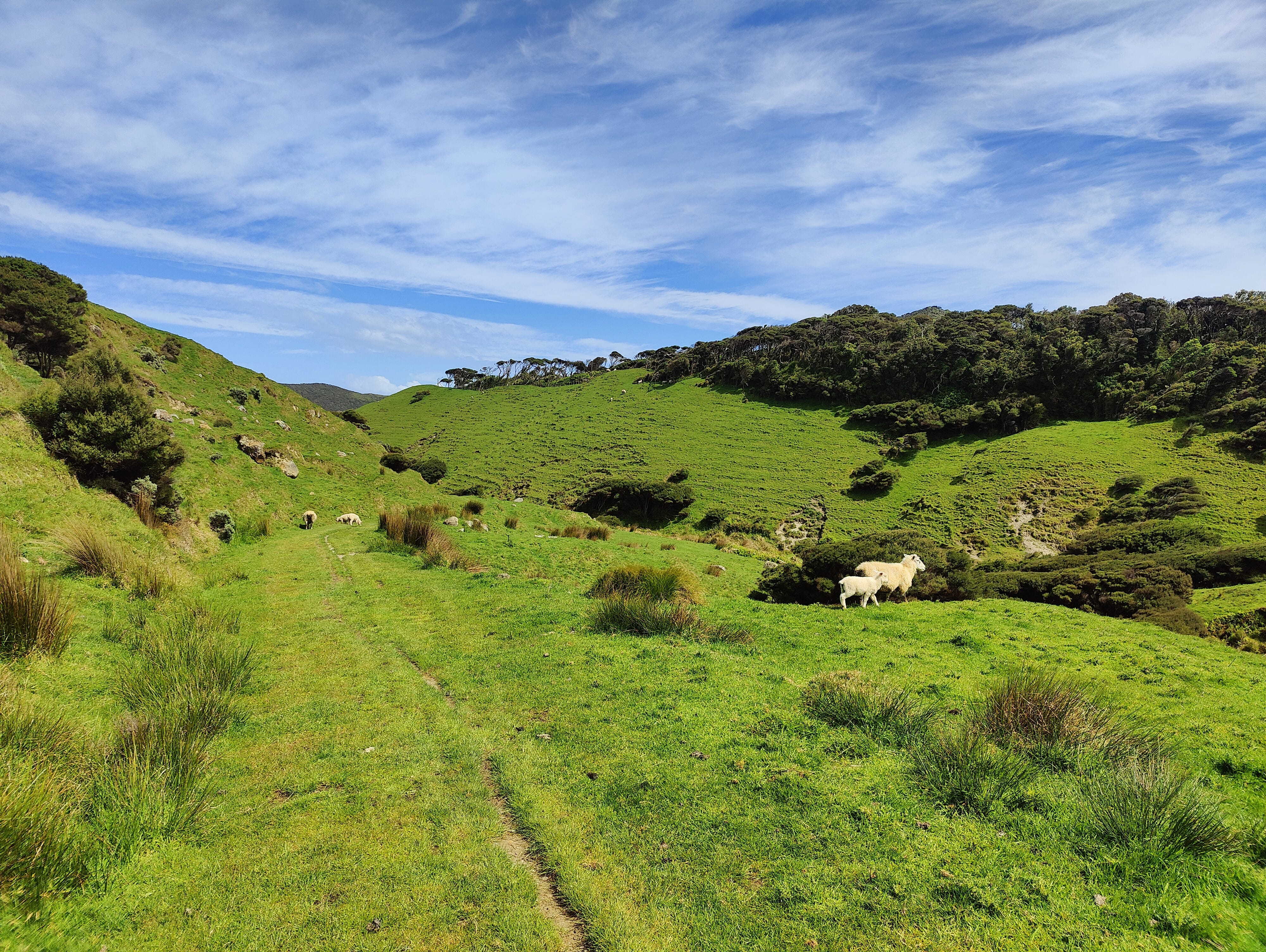
With several steep sections, the track follows the rolling hills through grassy farmland. The views of the ocean are unlimited, although the real magic is the vistas of the area’s unique coastal landscape.


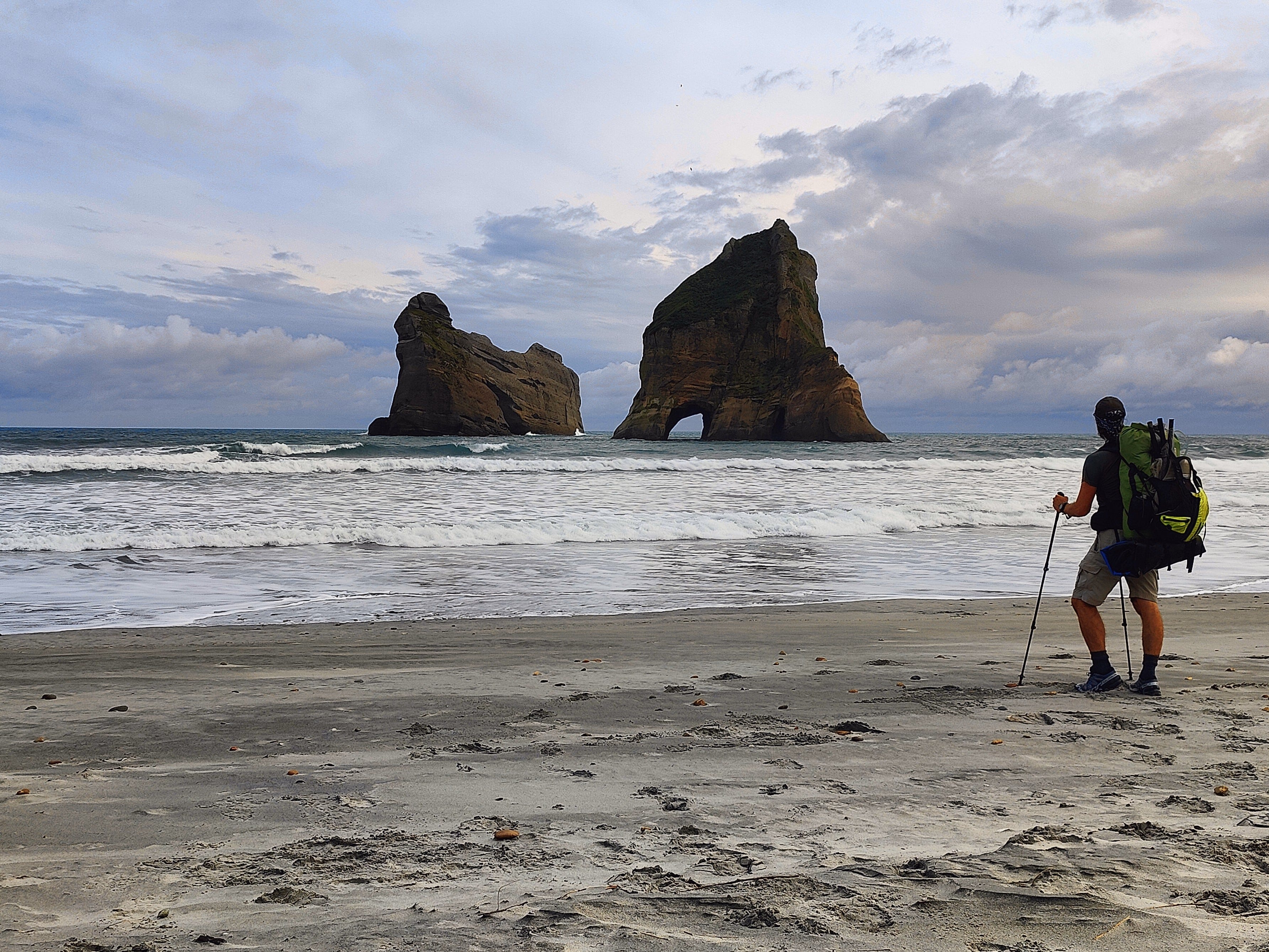
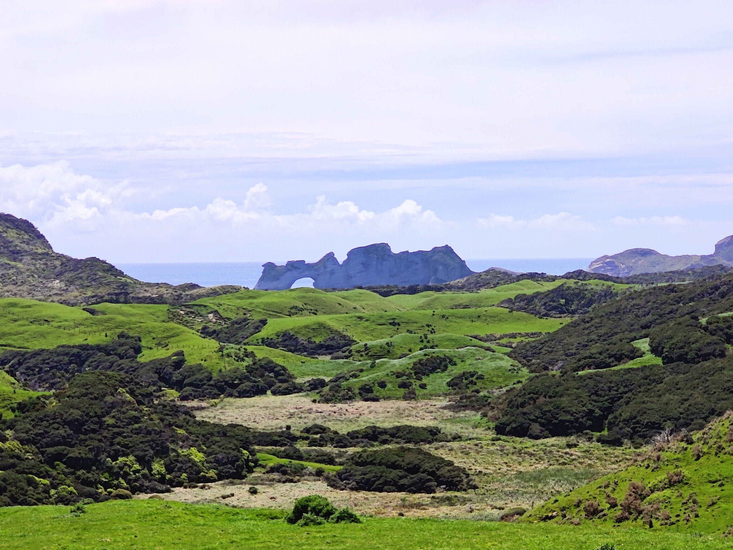
After a short time in the hills, the track delivered me to the eastern end of Wharariki Beach: world-famous for that shot of the Archway Islands, taken from within a cave and given away as a stock lock image on Microsoft’s Windows 10. Scores of people are attracted to this remote beach location, boosted by the fact it is actually awesome.
The tide was still high, so I couldn’t use the beach’s full length and walk over to its western access track. Instead, I staged a photoshoot on the sand in front of the archway, before trotting up and over the dunes and onto the main beach access track. This leads back to the car park, which is adjacent to the holiday park where this day had begun. However, before setting foot in the car park, I threw a right and continued my westerly float towards the Greenhills Loop Track, which sounds more like a level from Sonic The Hedgehog than it does a hiking track.
This is a track through a bunch of farm paddocks, complete with sheep loitering in the way. Unaware of this approaching monster, they nonchalantly chewed their grass, only catching wind of my hasty approach at the last second and breaking into an immediate sprint.
The morning cloud had risen, but there was also a large gap, through which the sun beamed down, lending the grass an extra vivid appearance. My morning coffee and heavily-loaded walking had left me parched, so I paused by a small creek and filled my filter bottle with its flowing juices - presumably some random combination of water and sheep wee. I pressed the filter through the clear liquid and took a sip: “Water! Delicious!”
Several kilometres south of where I stood lies the Whanganui Inlet, a giant harbour joined by a small gap to the rampant Tasman Sea. My intention was to cross it in my boat. But first, I had to get there, across a private farm. Remembering a former colleague, Holly, had connections to the area, I’d messaged her a few weeks before, trying for a contact. Her Dad was away whitebaiting, but a friend came through with a number for a man named Pax. I sent a text to Pax2 and he came back with a “yes”. I was crossing the farm!
A neat and new-looking wooden bridge took me over Green Hills Stream, and I continued onto the southern section of the loop track, which started to gently climb. We were leaving the north coast behind. I followed the wide track and dropped down into a wetter, boggy area between two hills, through an open gate and began the gentle climb up the other side. Pax’s instructions were to just jump the fence into his farm, so I was monitoring my Topo map and GPS for when that would need to happen. It was during a random glance at the map that I noticed I’d already left the public track. “When did that happen?” I wondered, looking back at the hillside behind me and noticing the now-obvious orange track marker poles. “Guess I’ll be on the farm a bit sooner.”
I don’t really know when I stepped onto the farm, but I know I did at some point. The wide vehicle track petered out and I found myself following animal tracks and two lines of pressed grass, presumably left in the wake of two farm bikes. These and the GPS were now my guide.
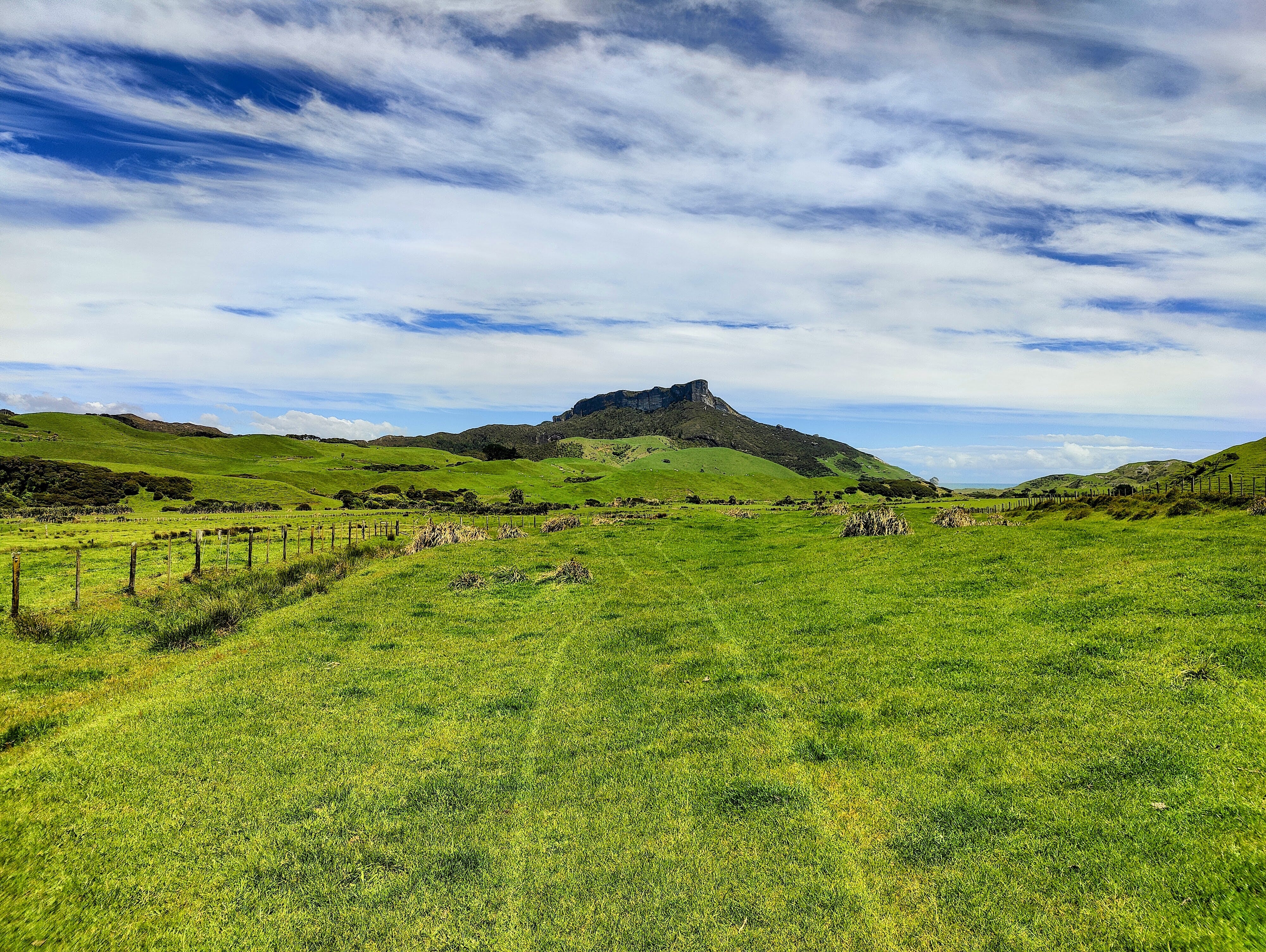
Unfit from many months of travel around Europe and China, without much of my usual exercise routine, I wearily pushed on my legs, dragging my weighty pack to what looked like the top of the biggest hill. The views back to Wharariki and the Archway Islands were spectacular, so I paused for a moment to take them in: I may never see them from this angle again.
Over the next hour, I snaked my way through the paddocks, following the compressed lines of grass, in the approximate direction of the homestead. The green expanse was epic. Geographic interruptions included a glimpse of the West Coast, to the right of a large, pointed rock stack bursting out the top of a hill. To my left lay the dark green native forest of the Kahurangi National Park’s most northern section.
As I gained on the housing, the route became more defined. Eventually, a yellow, gravel track led up the last slope to the farmyard. As I approached, I noticed several large cows sat right on it, right in my way. Would they budge? Slightly, it turned out, but only slightly.
Pax had warned me they wouldn’t be home, so I marched straight on through the deserted farmyard and out onto the public gravel road beyond. That would lead me down to the northern edge of the inlet. The high cloud seemed to be building and the sun was now behind it. Would I face rain on my first day?
Unlikely, as I arrived at the inlet to an onslaught from the southwesterly wind that the afternoon had ramped up. White horses crashed all over the place on the choppy water. I stood on a small causeway, built for the road around the inlet, and watched the water getting sucked out from the mangrove-laden pool across the road. There was plenty of water to still launch, if I wanted to, but I didn’t want to.
A lot of the Whanganui Inlet is mud and impassable at low tide. With the tide going out and a sou’wester busting in, most of my intended southbound journey would be wind-over-tide. Otherwise known as ‘lumpy’. Add to that the headwind factor and I had a recipe for ‘not fun’. In the name of not being a duffer, I sat on the rocks of the causeway and mulled my decision for ten minutes, finally deciding: find somewhere to bed down for the night and come back tomorrow.
Signal on my phone allowed me to read the reviews and info on the nearby Kaihoka Lakes. They had a toilet and were less than 2km up the road. In these extremely rural parts, that was practically a holiday park! Eager to find a temporary base, I hoisted my pack back upon my shoulders and began the climb up the road.
The wind had shoved the cloud out the way and the full sun now seared everything, offsetting the cooling effect of the gusts. I walked past a farm, where a lone farmer performed his tasks, such as reversing his ute up the driveway to the barn. He can’t have seen me, as he didn’t acknowledge me and people in those sorts of places usually do.
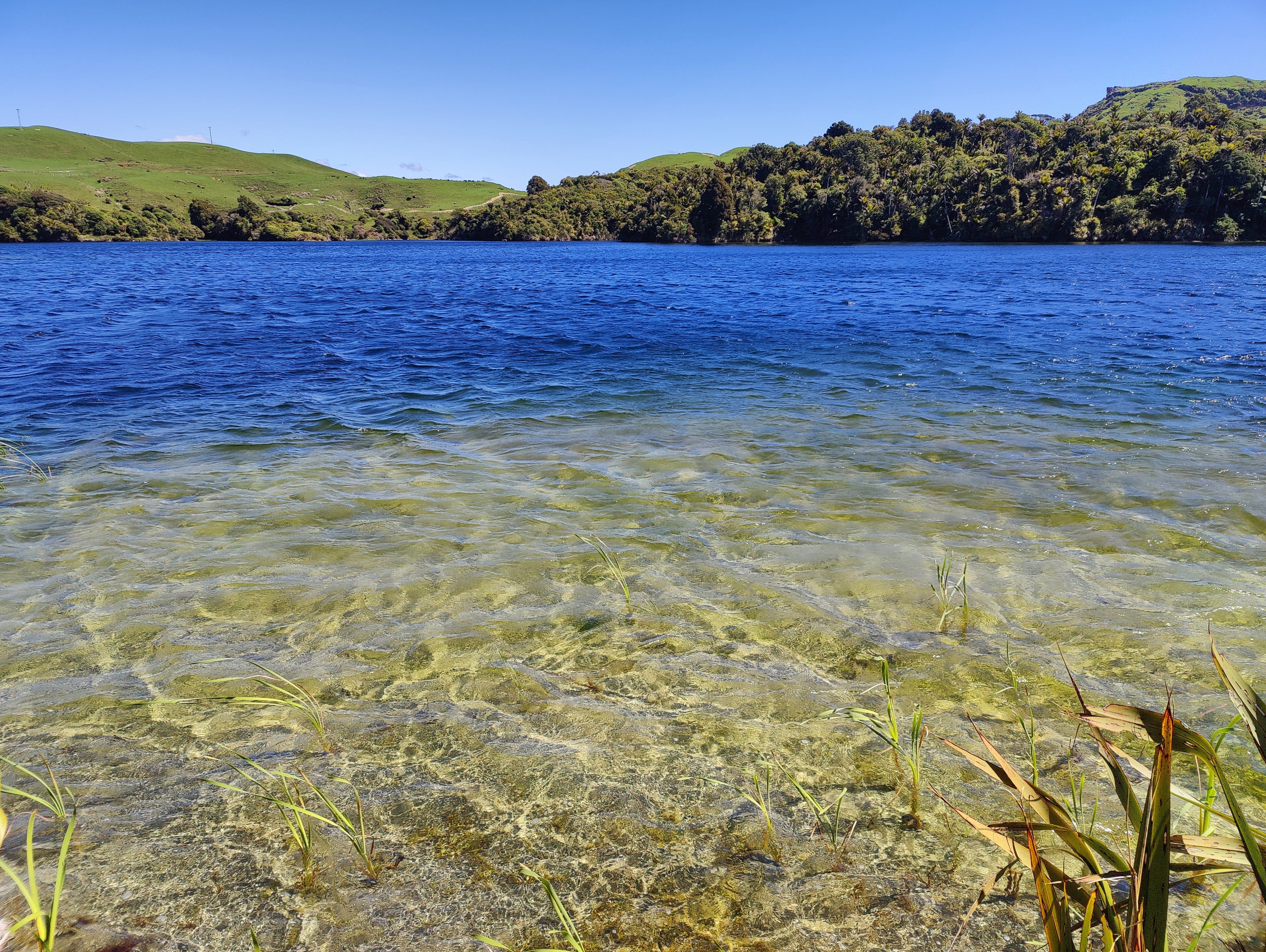
The lakes were incredible, exactly as the reviews had implied. The deal-breaking longdrop toilet was in a small vehicle parking area, which merged without boundary into the sandy beach. Crystal clear waves lapped at the white sand. Native nīkau palms stood firm around the lake, their vibrant green fronds swaying in the wind.
I placed my pack by a picnic bench and had a look around the foreshore for an obvious, but inconspicuous place to bed down for the night. The only flat patch of grass was next to a wooden ‘no camping’ sign. Never an ideal spot to pitch a tent.
I stashed my pack in a small woodland behind the toilet and embarked on the 600 metre track to the other Kaihoka Lake. The track was straight, with some level sections ideal for a tent, but it lost points due to the distance from the toilet!
Ultimately, I reasoned I should sit out by the lake and wait. If nobody showed that afternoon, in all likelihood, I would be fine until dawn.Okay, new challenge: sit and wait. While sunny, the wind was cold and there few places of refuge. The best I could do was hole up behind a giant flax, right on the lakefront. The leaves were clapping in the wind, but I lay my pack down and managed to boil my pot for a cup of tea. There I sat, counting down the clock and watching for people; dull, but important work.
5pm passed and I found myself gazing up at the giant rocky range between these dune lakes and the ocean; 6pm came and I heard a car drive past, the tyres scrunching the gravel, emitting a familiar sound; 7pm came and I cast my gaze yet again towards the rocky range - was that the silhouette of a person walking their dog along the top? I doubt it.
At some point, I boiled water and made my spiced TVP and bulghur wheat combo for dinner. I chewed on a spoonful of it wearily and realised I would be eating this a lot over the next few days.
Despite not being interesting, it was an interesting afternoon to look back on; an exercise in tolerance. I didn’t know how many days it would be until I could ‘charge all the things’, so phone time had been restricted;creating an exercise in restraint. By the time 8pm rolled around, I just wanted the day to end.
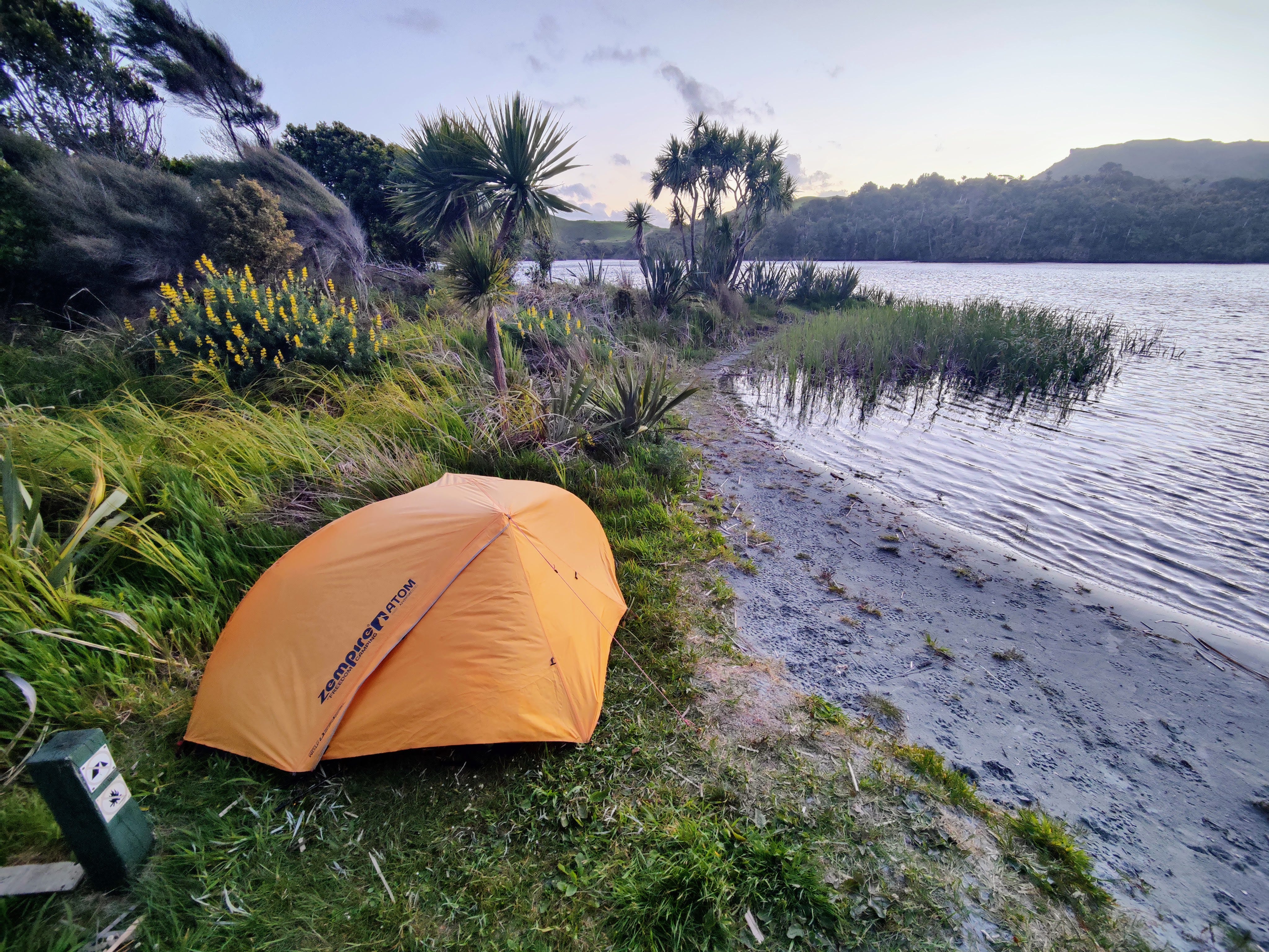
I unrolled my tent and took my time putting it up, beside the sign. Not as an act of defiance - it really was the best spot. The light was rapidly dipping, the sun threatening to disappear behind the rocky range. The outline of the person and their dog remained in their positions, a metaphor for me that afternoon. Tomorrow would be different.
Inside my tent, I prepared my bed and grabbed my phone for one final task: to set a 5:33am alarm. Last thing I wanted was to be screamed awake by an angry dog walker.
A commonly accepted Māori name for the South Island. Te Wai Pounamu translates literally as ‘greenstone waters’, referring to the large amount of nephrite, or NZ jade, found in the South Island.
Try saying that really fast!
❤️❤️